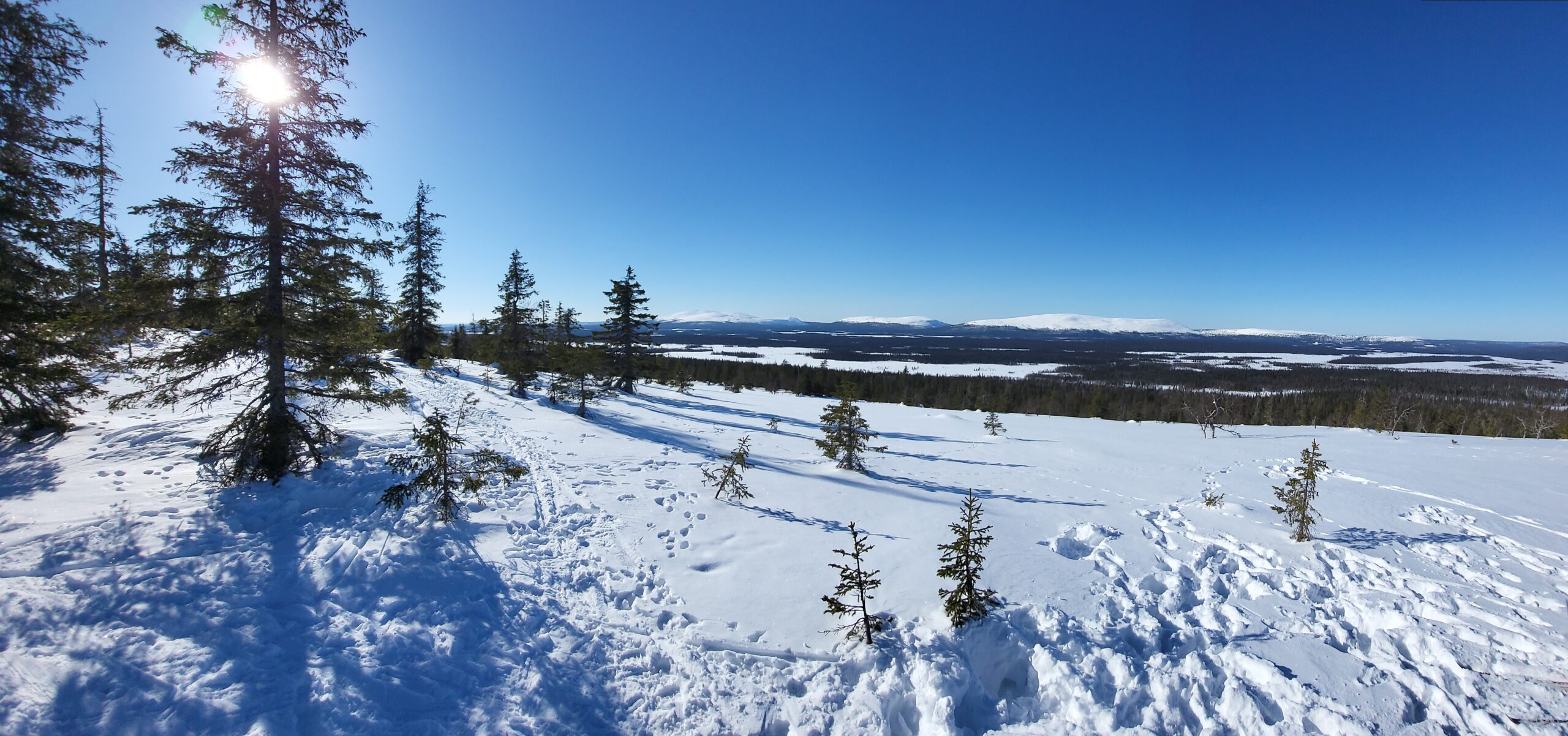
Long time no blog..
Five days of skiing in Äksälomopolo, punctuated by two days of Norovirus 🙁
Great winter weather, possibly because of the early dates for Easter this year.
Long time no blog..
Five days of skiing in Äksälomopolo, punctuated by two days of Norovirus 🙁
Great winter weather, possibly because of the early dates for Easter this year.
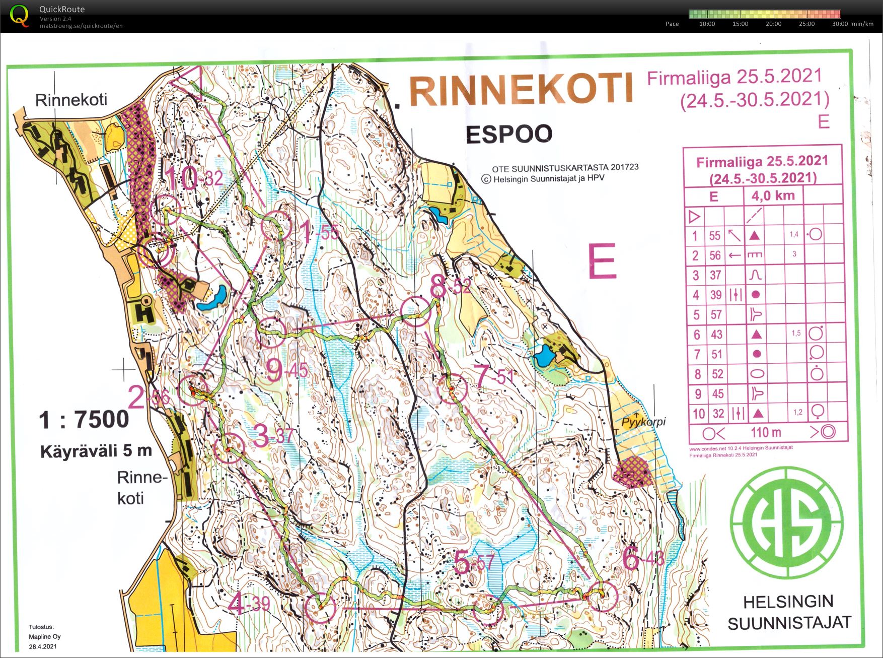
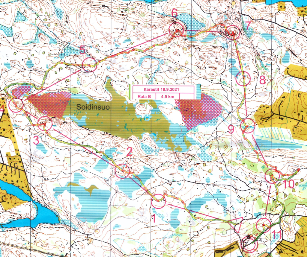
Mistakes on #4 and #8 - slow terrain.
Sunshine and maybe +11..13C.
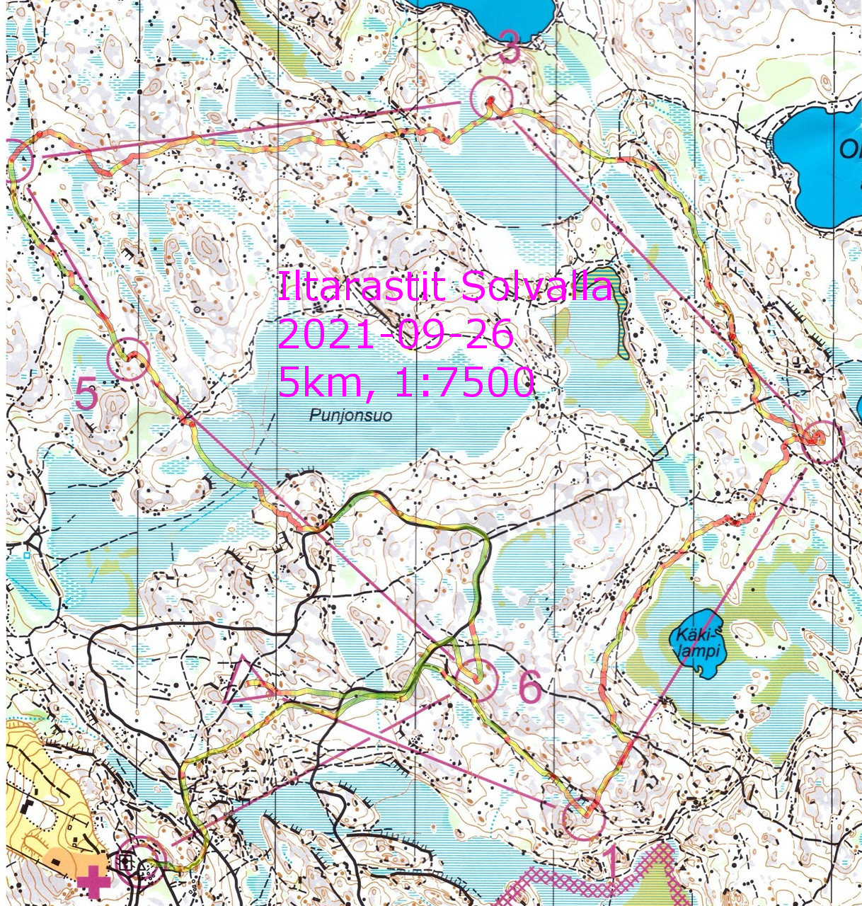
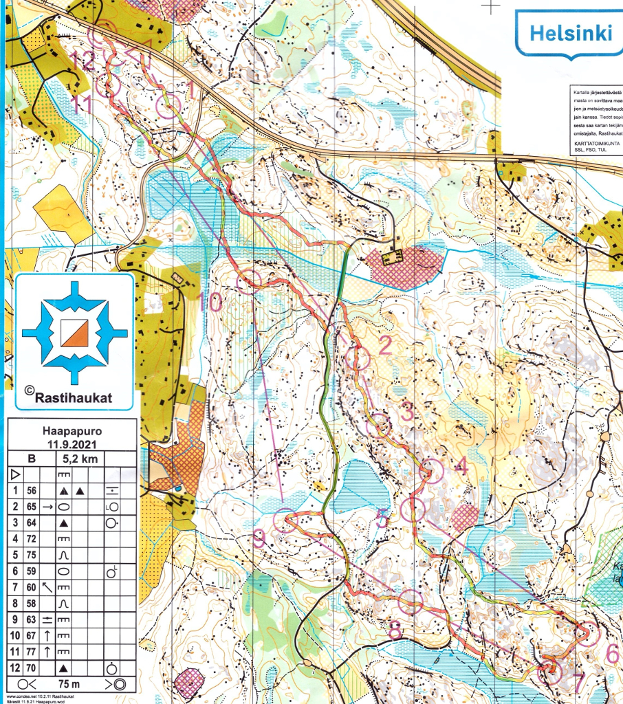
Really nice runnable terrain! Maybe +12 C or so. Felt a bit unsure after #5 when the bigger path towards #6 didn't appear soon enough. Big mistake on #10 where just before the control I searched left instead of right..
A bit difficult terrain until #2, but then really nice until #9 or so when my fitness ran out..
Mistakes at the start into #2 (passed really close on the first try) and direction into #3 (should have found the dashed stream?). Otherwise quite easy running along roads and paths. Sunny and +15 C or so.
Easier course than the last two weeks - mostly running along paths. +15C or so.
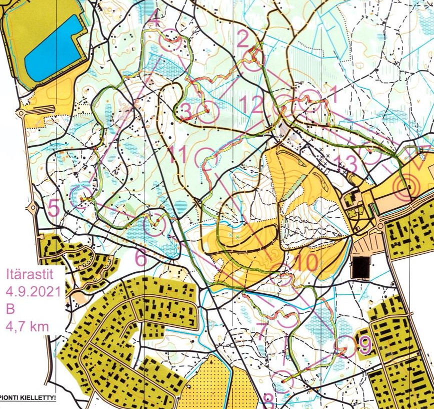
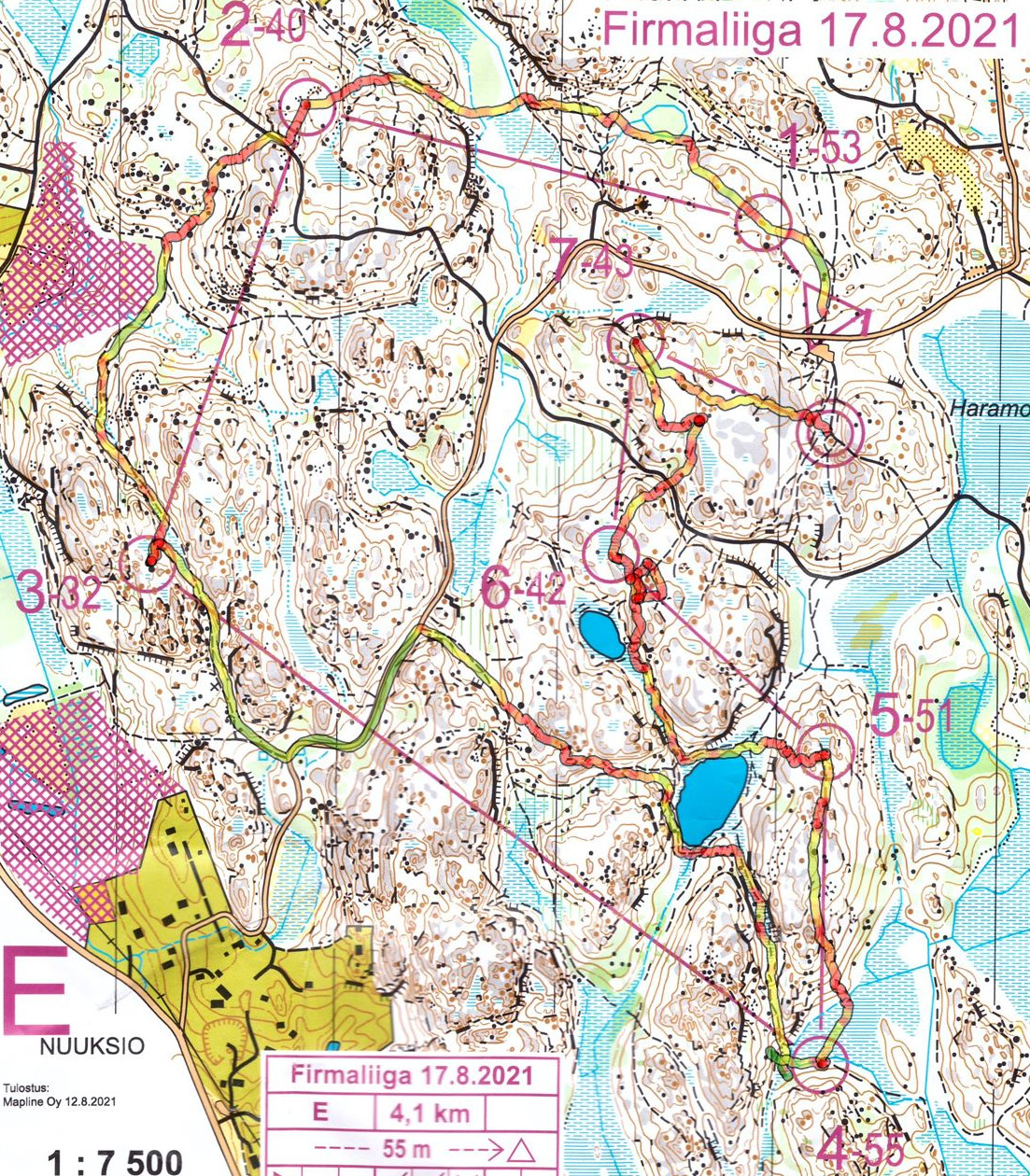
Rainy and wet but quite warm. First a loop looking for #6 too soon, and then along the wrong hill towards #7..
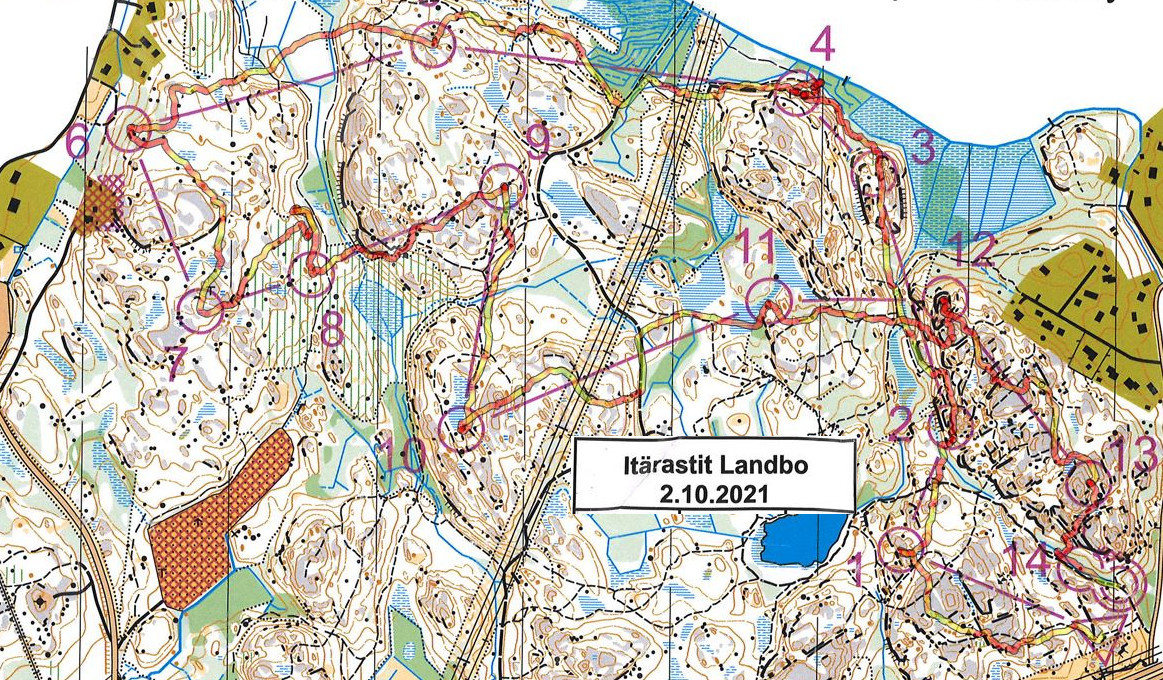
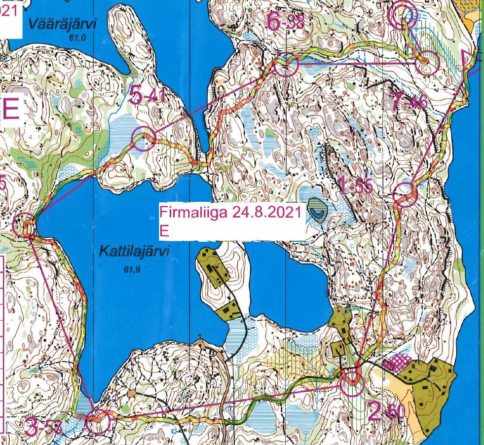
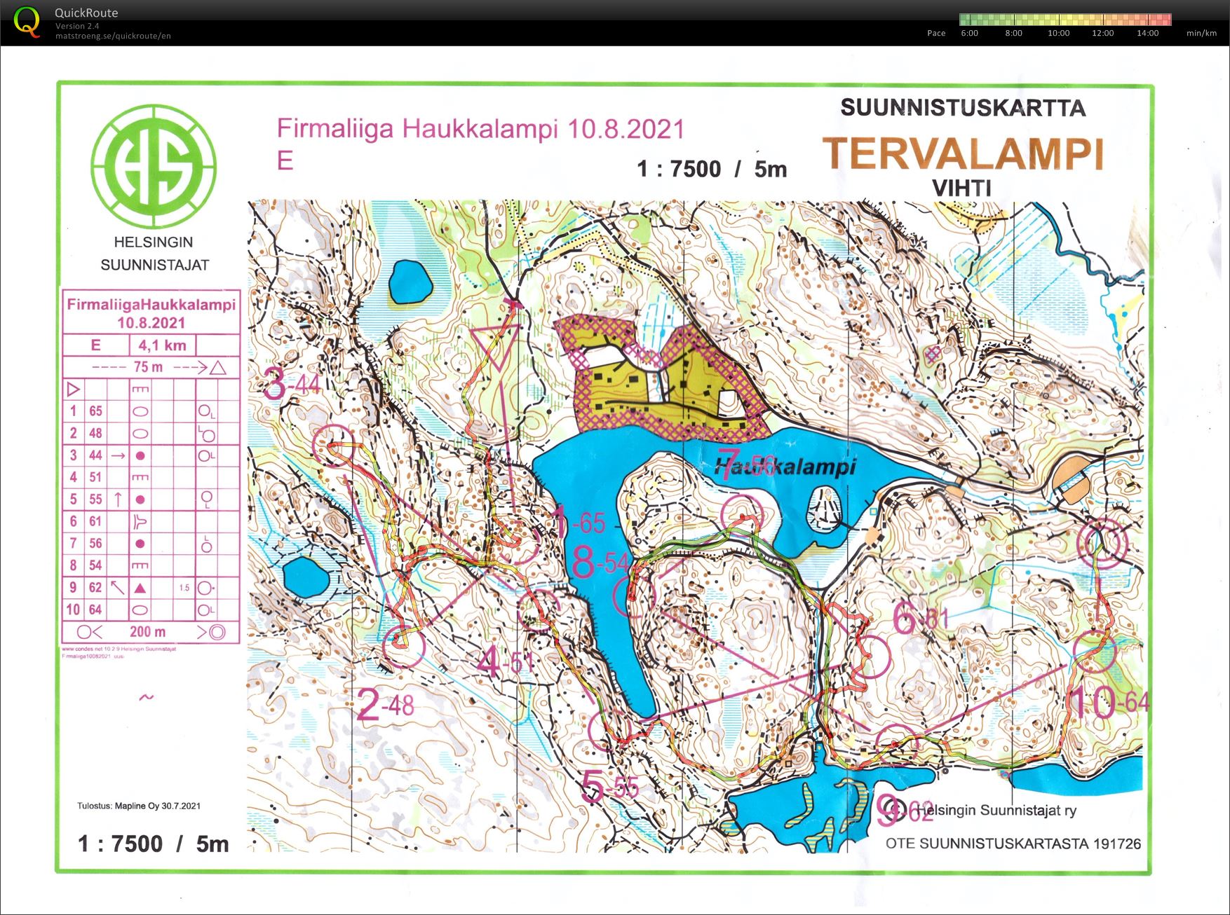
Start of the Firmaliiga fall season at Haukkalampi. Maybe +20 C and quite humid.
Lots of running along tracks/paths and then up/down a steep stony hill to fetch the control. Confused about the many paths inside the 1-2-3 triangle, then looked to early and too high for #6. Otherwise okish.
The start was on a road wher this crazy youtuber did an everesting...
Drifted onto the wrong hill at #8, otherwise mostly ok. Not the nicest terrain to run in... +15C and sunshine.