KU-rastit, Linnanpelto

2014-09-11_KU_linnanpelto_qr_splits

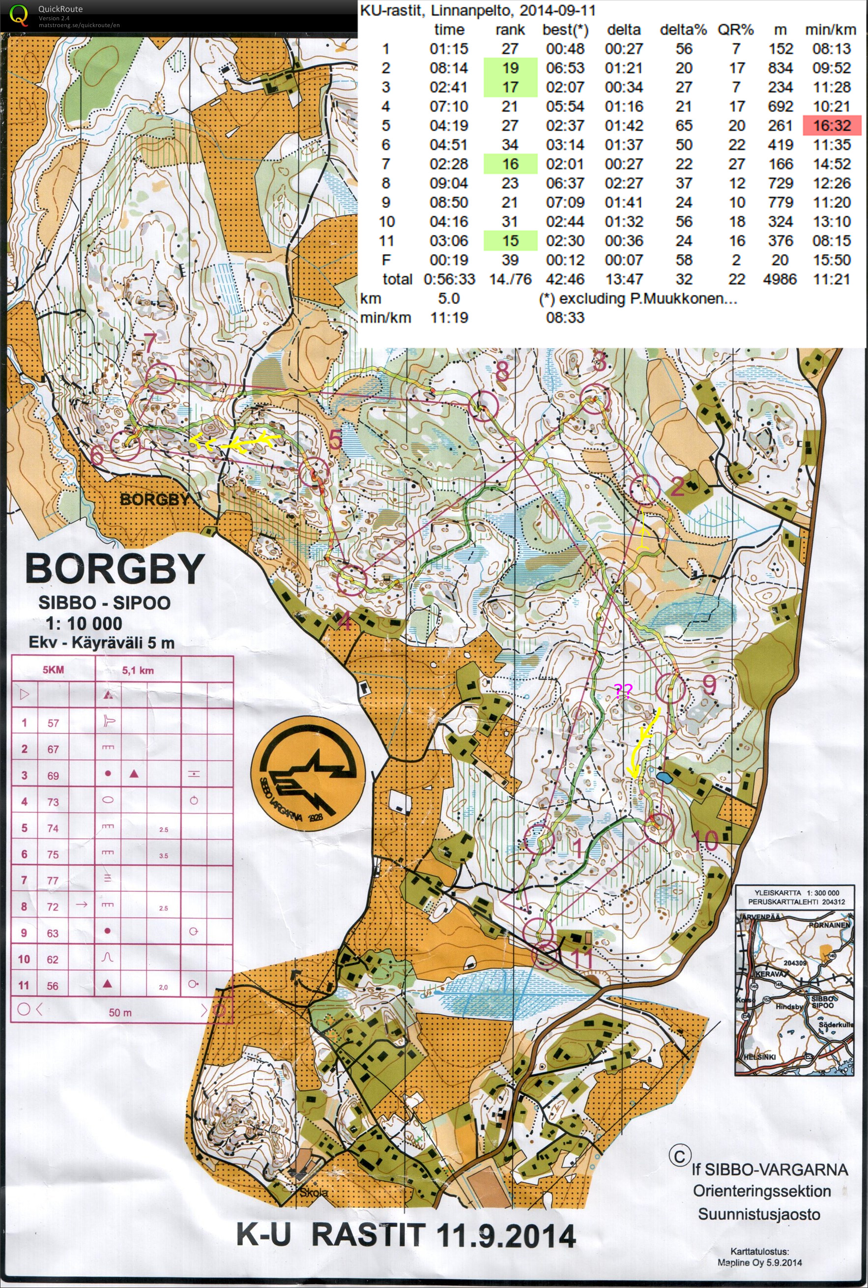
En route to #2 about half-way there was an open cut-down area not marked on the map (??) and then just before the control I turned a bit much to the east.

#3 and #4 went well, and #5 OK but slower. Towards #6 I ran along the grey cliff and after the road failed to directly find the smaller path towards the control.

#7 was surprisingly high up on top of a hill, while the quite long legs to #8 and #9 I managed to complete fairly straight along the control-line. To #9 a route along the road north would have been worth considering.

A route more westward out of #9 to avoid the slow area close to the backyard and lake would probably have been better towards #10.

KU-rastit, Böleberget

Last orienteering practice before the Jukola relay. 5k course at Böleberget in Sipoo.

Slightly nervous right at the start on #1, OKish #2, then I probably unnecessarily avoided a green area that was marked slow on the map en route to #3.  Then mostly OK through #7. Going towards #8 there's an extra U-shaped bit which should have been straight. But then on the shortest leg of the course between #9 and #10 I somehow lost it and spent 8 minutes searching for #10. Probably frustrated by that I drifted too much down and right on the way to #11, almost stumbling on #12 instead.

Kerava night Orienteering

4.2km course. Ran about 5.45km in a time of 1h 4 mins.

A bit of a loop when searching for #1. Between #2-#3 there's some unnecessary zigzag. #5-#6 should have probably taken a straighter path on compass heading through the woods to the open clearing (now just ran along paths). Otherwise OK orienteering-wise, but quite slow going in the dark and rain. Would need more courage to run fast in the wet dark slippery conditions...