Around -14 C and 5-10cm light new snow on the ground.
Around -14 C and 5-10cm light new snow on the ground.
An easy jog to start the 2016 orienteering year. -8 C and 2-3 cm of snow on the ground. Not too much wind so not that cold.
Last Sunday of the winter-orienteering series. 3km sprint-course + 3km ordinary course. OK steady pace, 58:16.
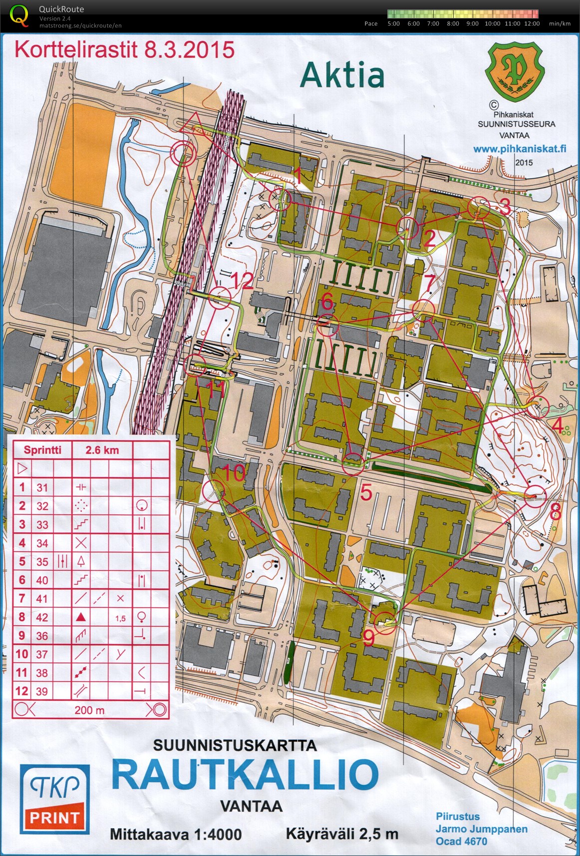
Short sprint-o course on 1:4000 map today. +4 C and grey.
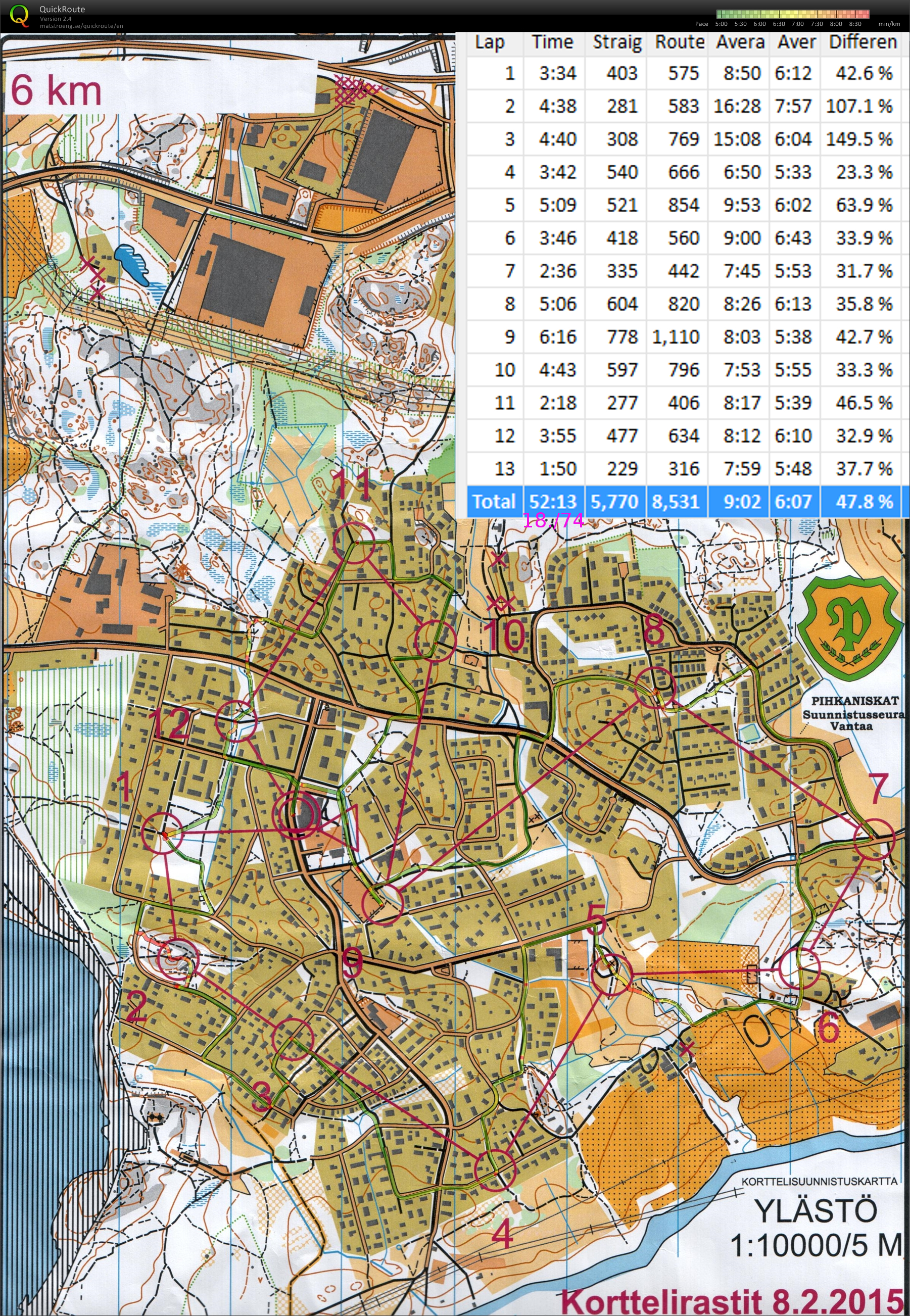
6 km course, about +2C and cloudy. Most snow has melted - no need for spiked shoes. 7.99km route at 5:51/km pace. Placing around 18th out of 107 runners. About 2 min of error in total.
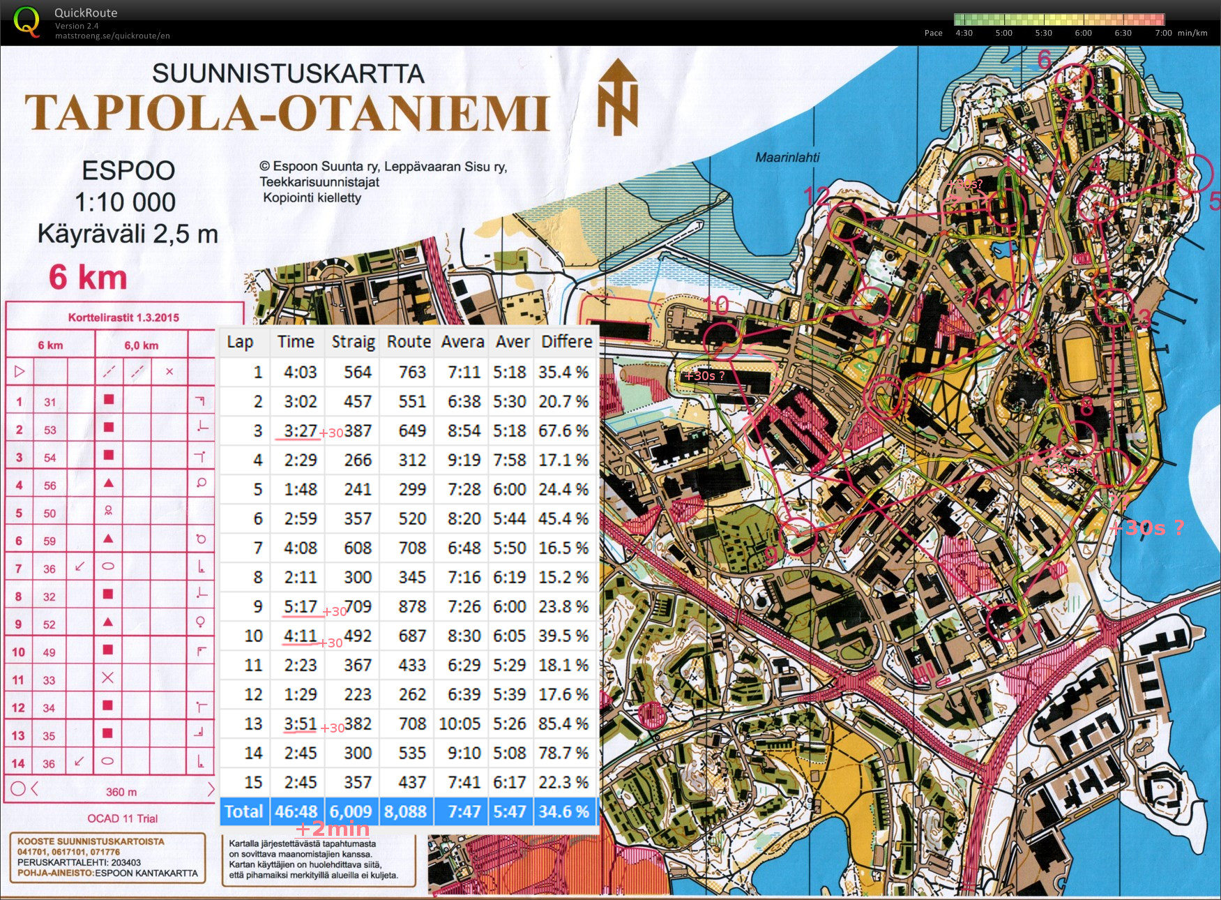
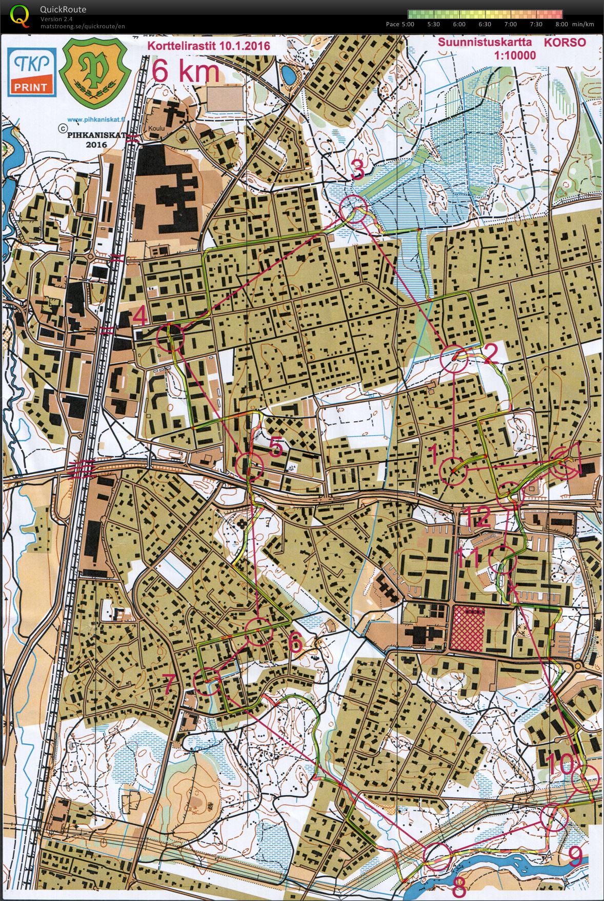
Start -> #1: along the rail-road in front of Heureka, then along the street might have been better. My route is more scenic along the river.
#5->#6 route choice between left or right side of the rail-road for the long straight bit. Close to the control I slow down at the right smaller road/path towards #6 but then I fail to make the turn there.
#8->#9 and #9->#10 on both of these legs the left route choice seems better in hindsight. Especially my S-shaped route to #10 does not look good.
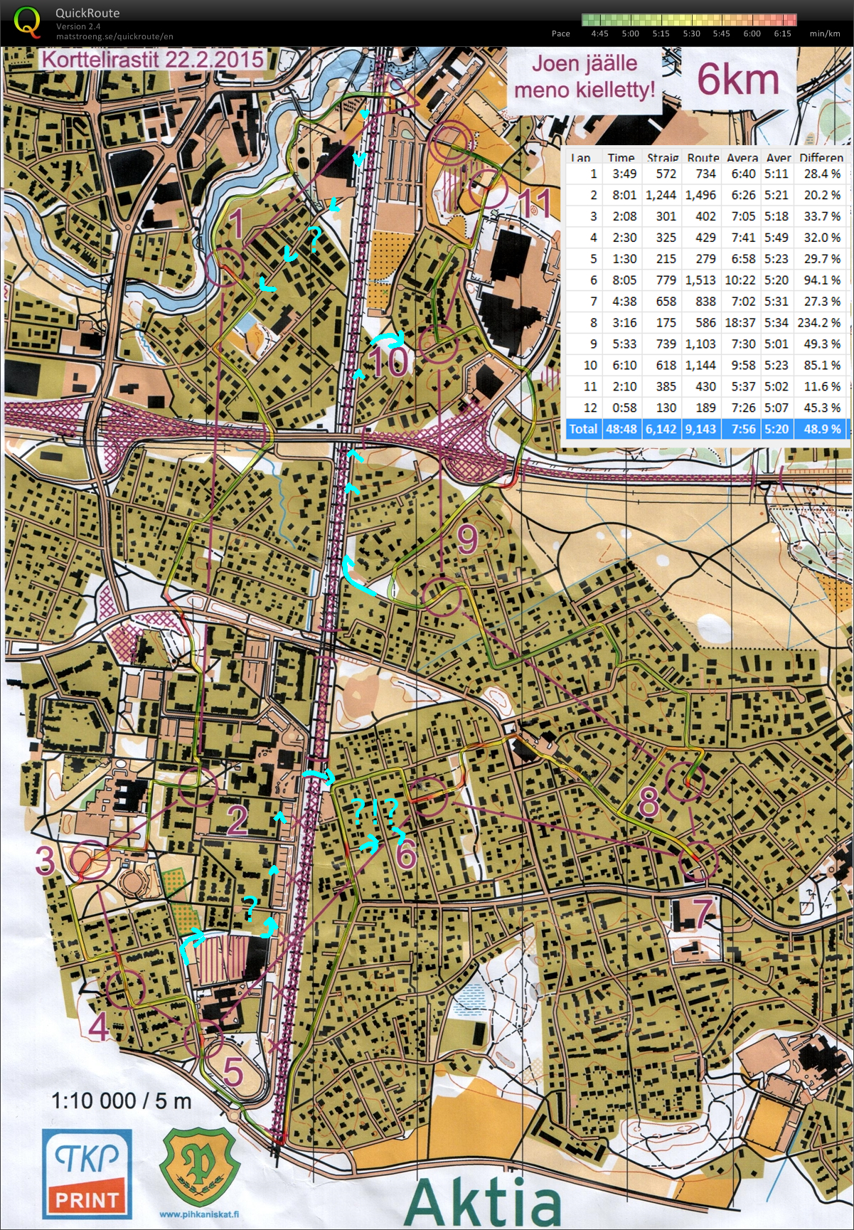
6km course, 9km route in 48min48s or 5:22/km. 11th out of 86 runners. Around +2 C, windy, and snow/rain at the start.
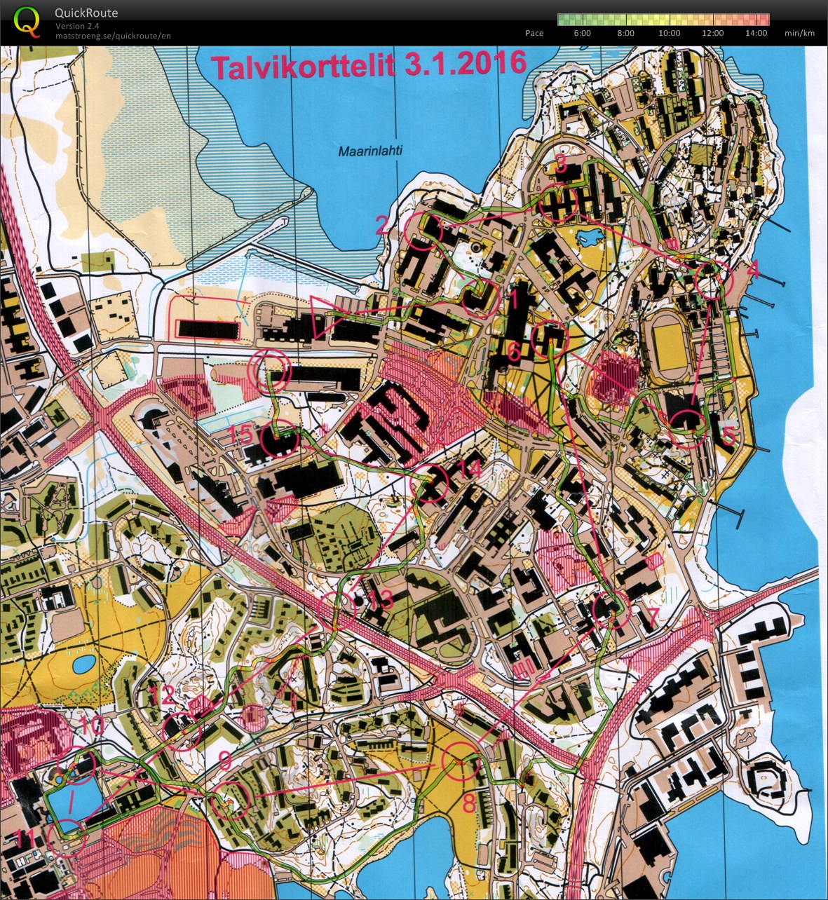
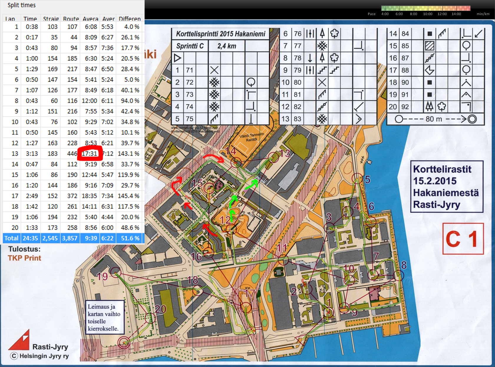
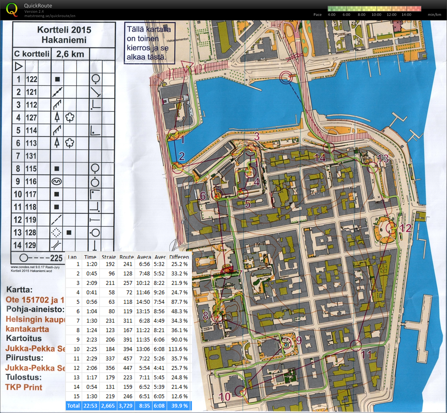
Sprint-O on familiar streets today. The 5 km course was composed of two sprint-courses, 2.4 km in Hakaniemi and 2.6 km in Kruununhaka. I didn't use a compass today 😉
The Polar V800 GPS did not work great on the Hakaniemi map and I had to correct the GPS-trace a lot to get this result. Mostly OK going, but out of #12 I took the wrong path down from the control-hill, assumed I had hit the right street leading towards #13, and ended up close to the forbidden area (Hämeentie). Green arrows show the correct path, probably up to 2 min lost here.
On the second course I didn't make any major mistakes. #3 was hard to say if it was reachable only below from the sloping hill, or also from the top along the much easier terrace with a fence. I took the slower path from below and then climbed the fence after finding the control. The way out from #8 towards #9 seems awkward and slow, but maybe there is no route directly south out of #8?
Total time 47min 22s for both courses. 12th place out of ca 63 runners.
Orienteering again after a long break - last event was in October 2014.
Easy course but lots of forbidden areas to avoid. Not too cold but quite windy.