On #2 I blame the poor map...
On #2 I blame the poor map...
1, 2, 3 OKish, then too slowly and carefully down the hill from #3 towards #4 - maybe directly south avoiding the slow green-dashed area would have been better. A little too much west out on the road after #5. BIG loop and slow walking around #7 - and then while being upset about this mistake pretty bad directions on both #10 and #11.
Zigzag course on a 1:8000 scale map.
Quite tentatively towards #1, catching the big cliff (yellow arrow) more by luck than skill and from there the control.
On #6 and #7 I tried to avoid the slow green areas but in hindsight my route is too zigzaggy. #9 ran out of steam a bit. #10 is the best split as I crossed the big path as planned and found the control via the big stone and swamp.
#11 is an identification mistake where I mistook a stone lower down for a one upper on the hillside (yellow arrow), resulting in a loop back to the control.
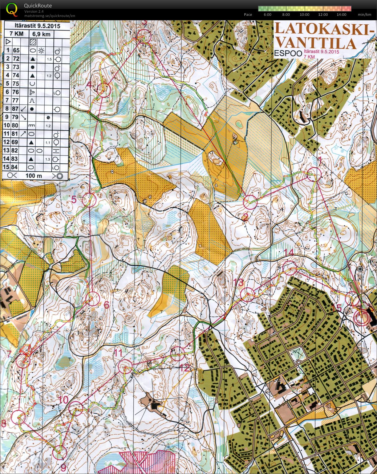
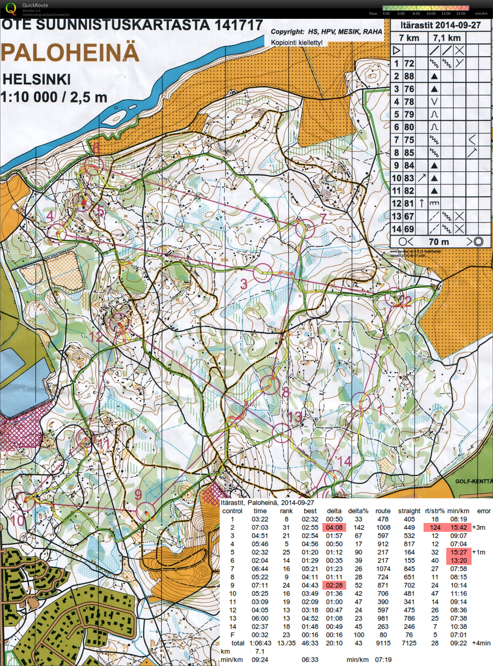
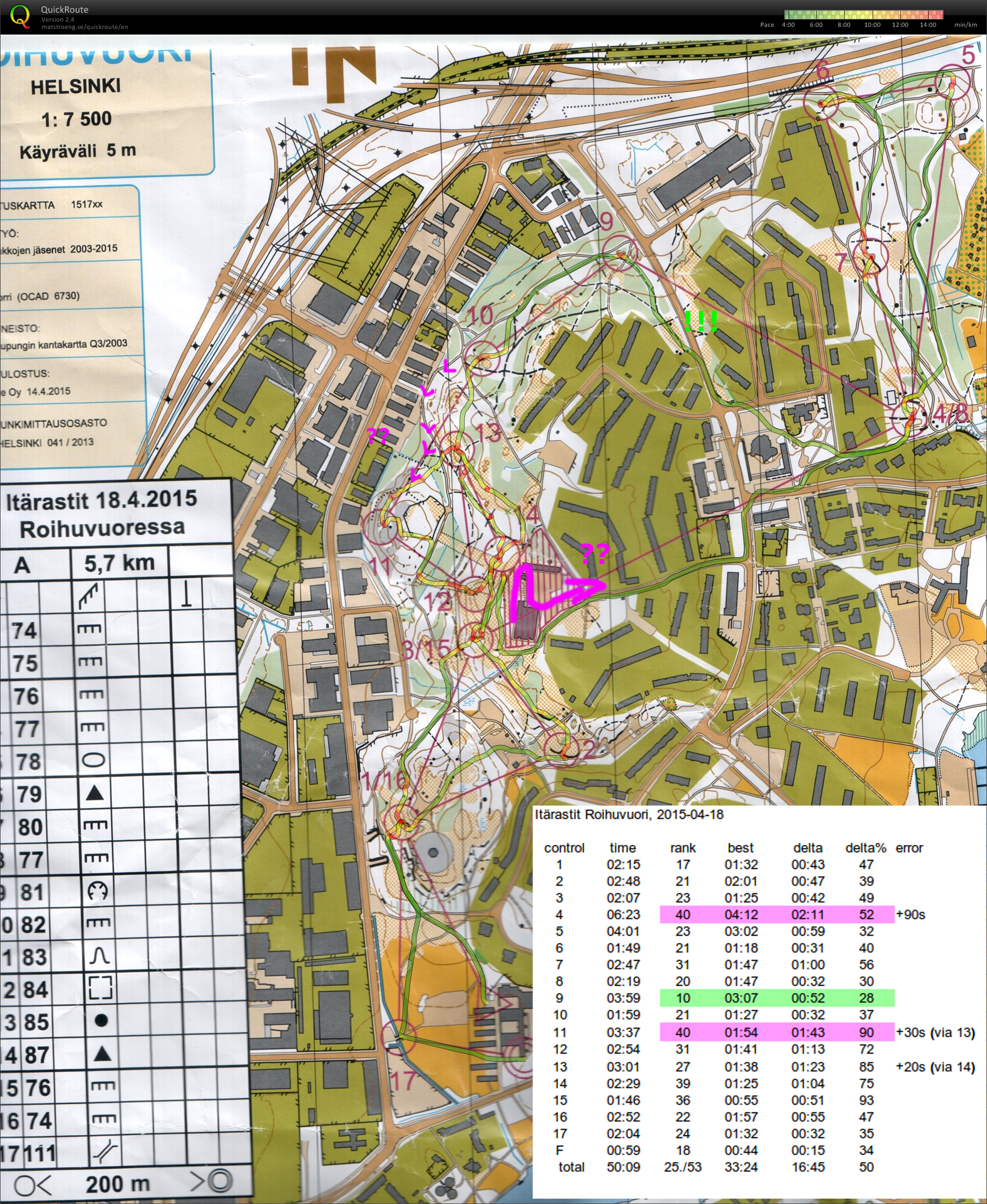 Easy course with lots of running along paths. From #3 I ran towards #15 for a bit before realizing the correct direction towards #4 - worst split. #9 is the best split - no orienteering required, just running. #11 is again slow and would have been faster along the road/path instead of over the hill via #13.
This was the last itärastit event for this year. See you next year in April again!
#2: wrong direction and slow pace out of #1 is probably the cause of the bad split.
#4: completely lost it when almost inside the control circle. Through to the big road and even ran along the road in the wrong direction for a bit...
#11 down the hill too much to the north, then looked for the control in the wrong place before I found the bend in the road,
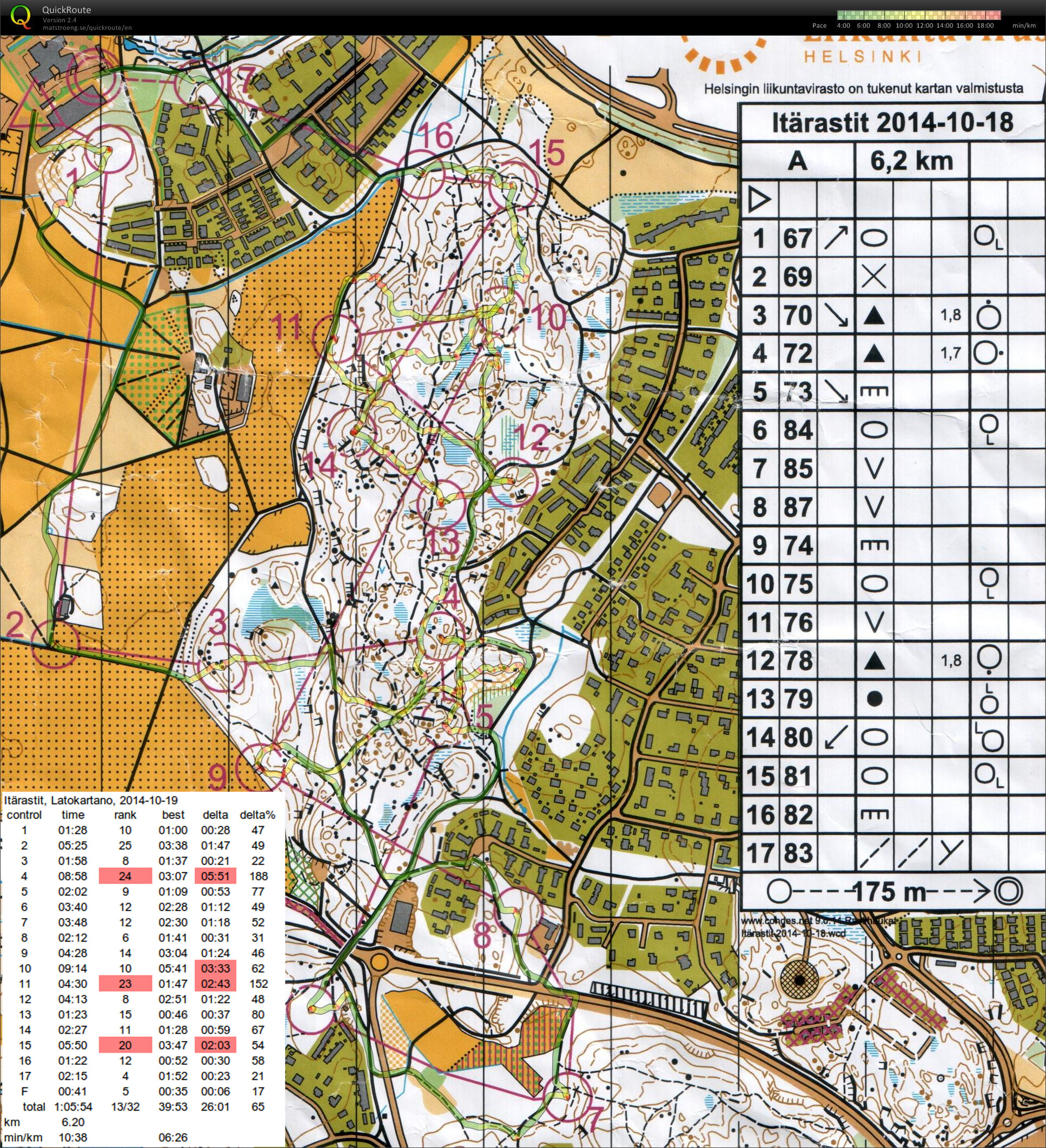
#15 tried to look for the path marked with a thick dashed line, but there are many paths and it's not clear which one to follow. Might have been faster to simplify the plan and run to the big road behind #10 first.
Had to use a hand-drawn map, since they had run out of printed maps.
Towards #1 I am correctly on course but then run down the hill to some big stones which were not the correct ones. Probably +2 minutes and the second-worst split.
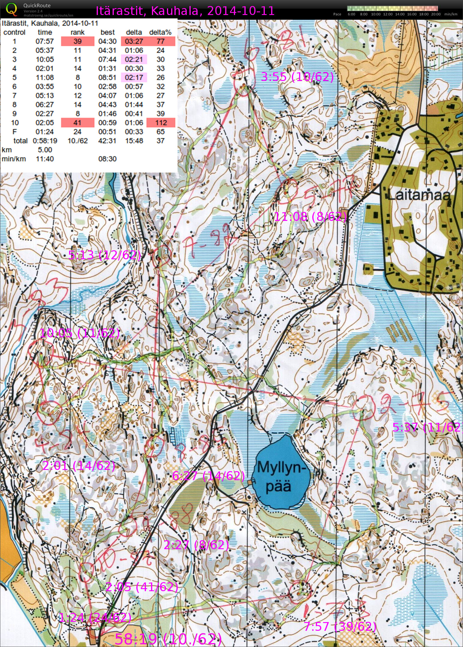
#5 is jointly the best split (with #9), but I would have liked to stay along the edge of the blue swamp and not drift right and high up on the hill.
#10 is the worst split, but a short leg so not that much time lost. Maybe everyone else used the two paths and the flag was clearly visible from the second path?
Overall 10th out of 62 runners which is OK.
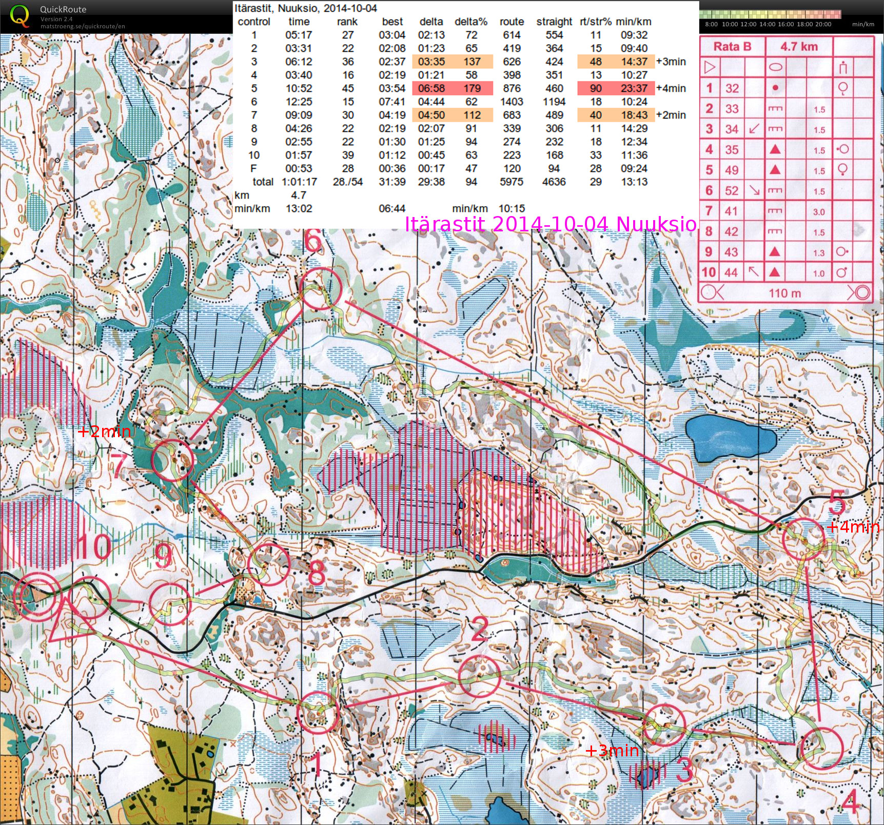
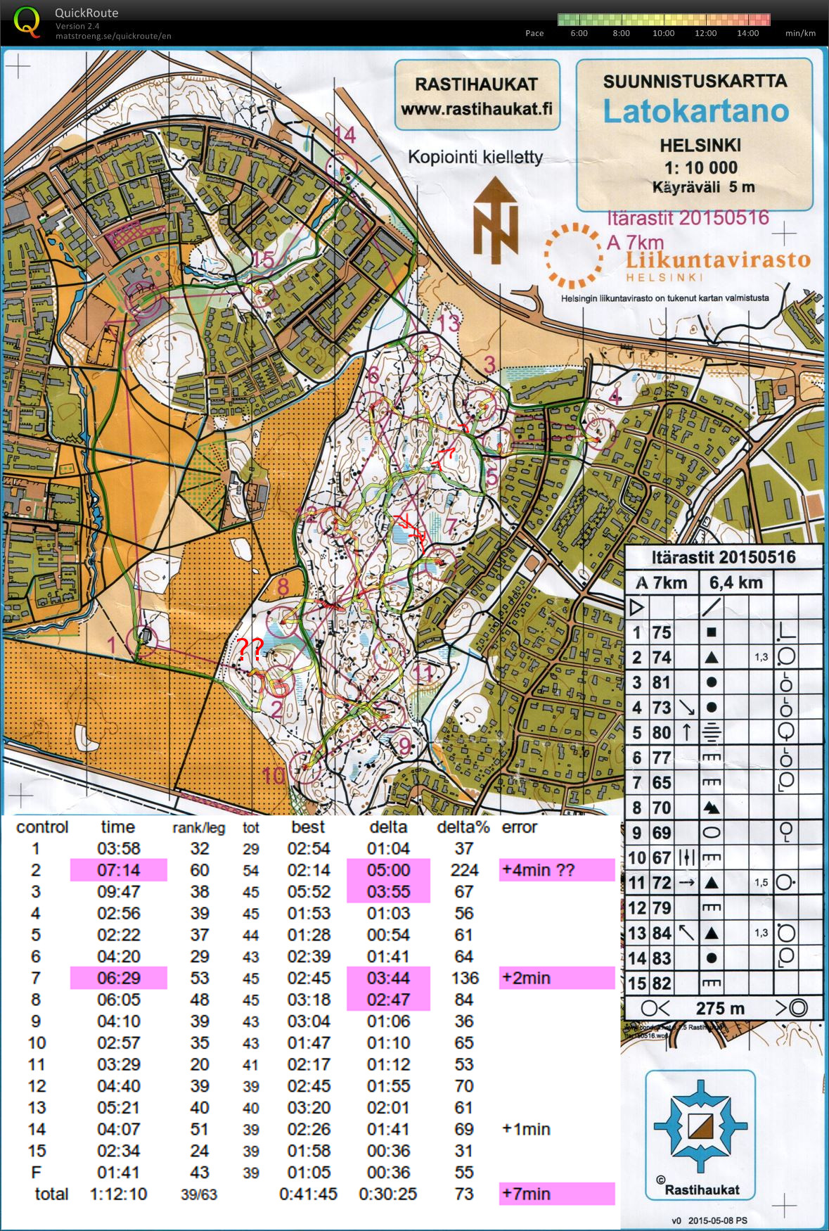
+3min loop when just inside the control-circle at #3. I blame other runners that distracted me.
+4min loop east of #5, also from within the control-circle, because I thought I had crossed the swamp west of the control and needed to look for it more to the east.
+2min at #7 because after the big swamp it was difficult to know where exactly through the green thick area one approached the control, and I mistook the westerly big stone for the more easterly one directly on the #6-#7 control-line.
Without the mistakes that cost +9min a top-10 placing would have been possible - well maybe next time...
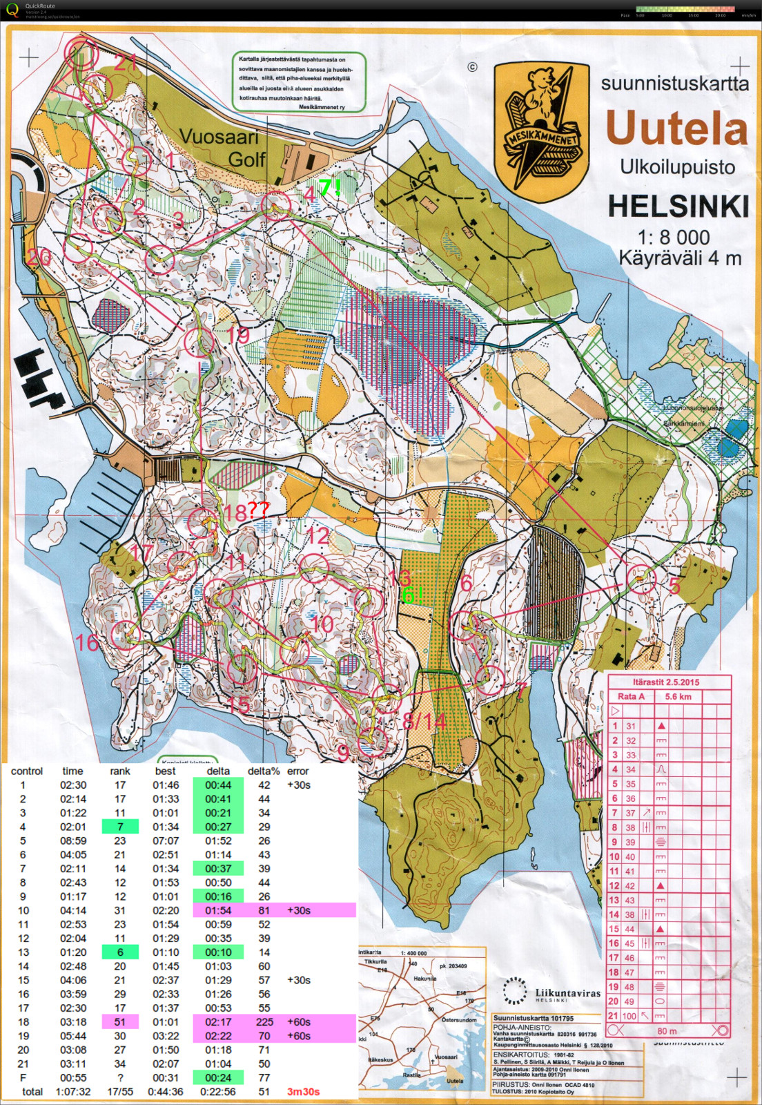
A great big loop around #2 that cost at least +3 minutes 🙁
Then I ran past #5, just didn't look in the right direction at the right moment. Maybe +1 minutes here.
Out of #8, should have avoided the green dashed slow area by rounding it clearly north or south - very slow going until I reached the road. Another minute lost there probably.
Overall an easy course with emphasis on running - as long as clear and good route choices could be made...
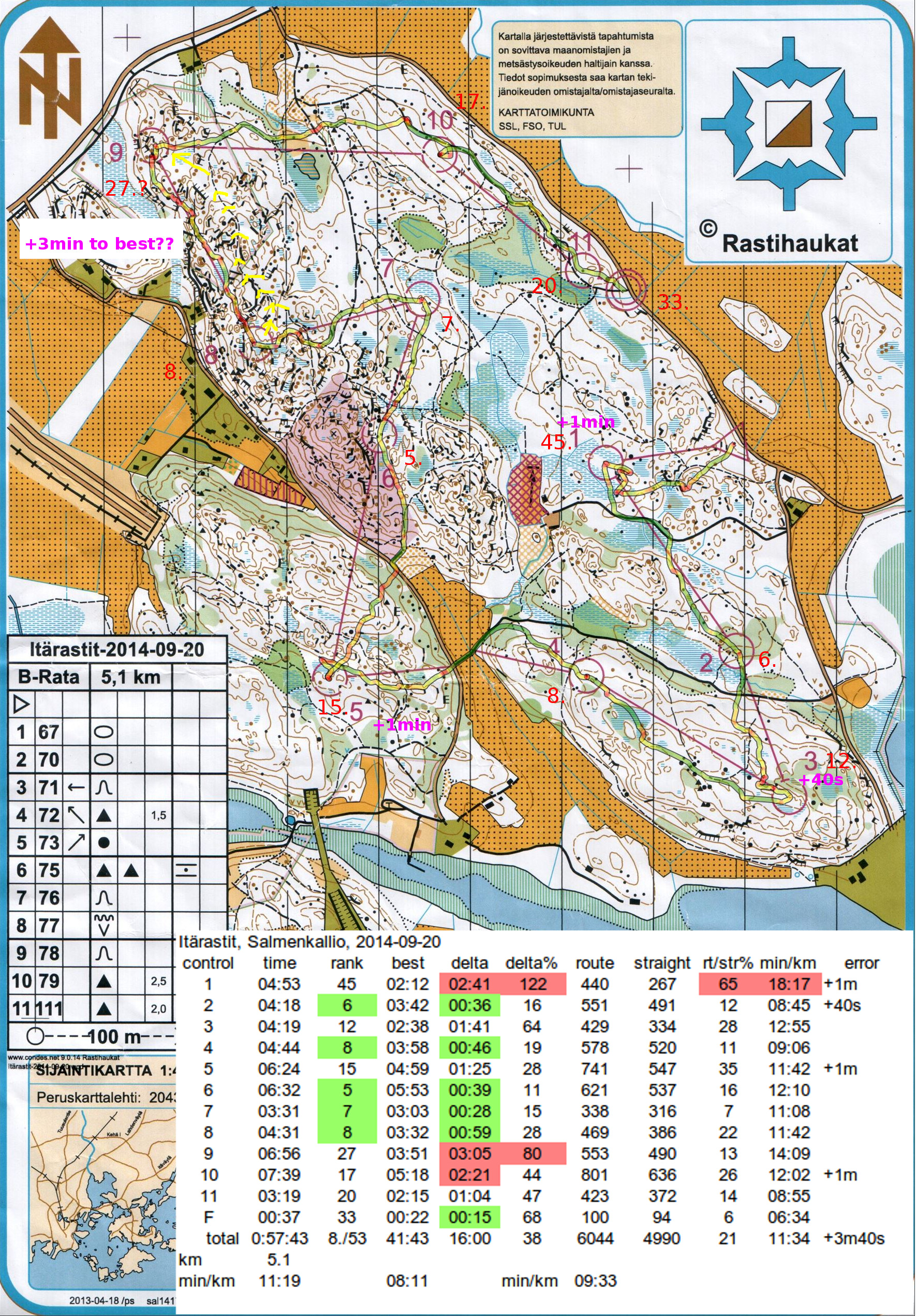
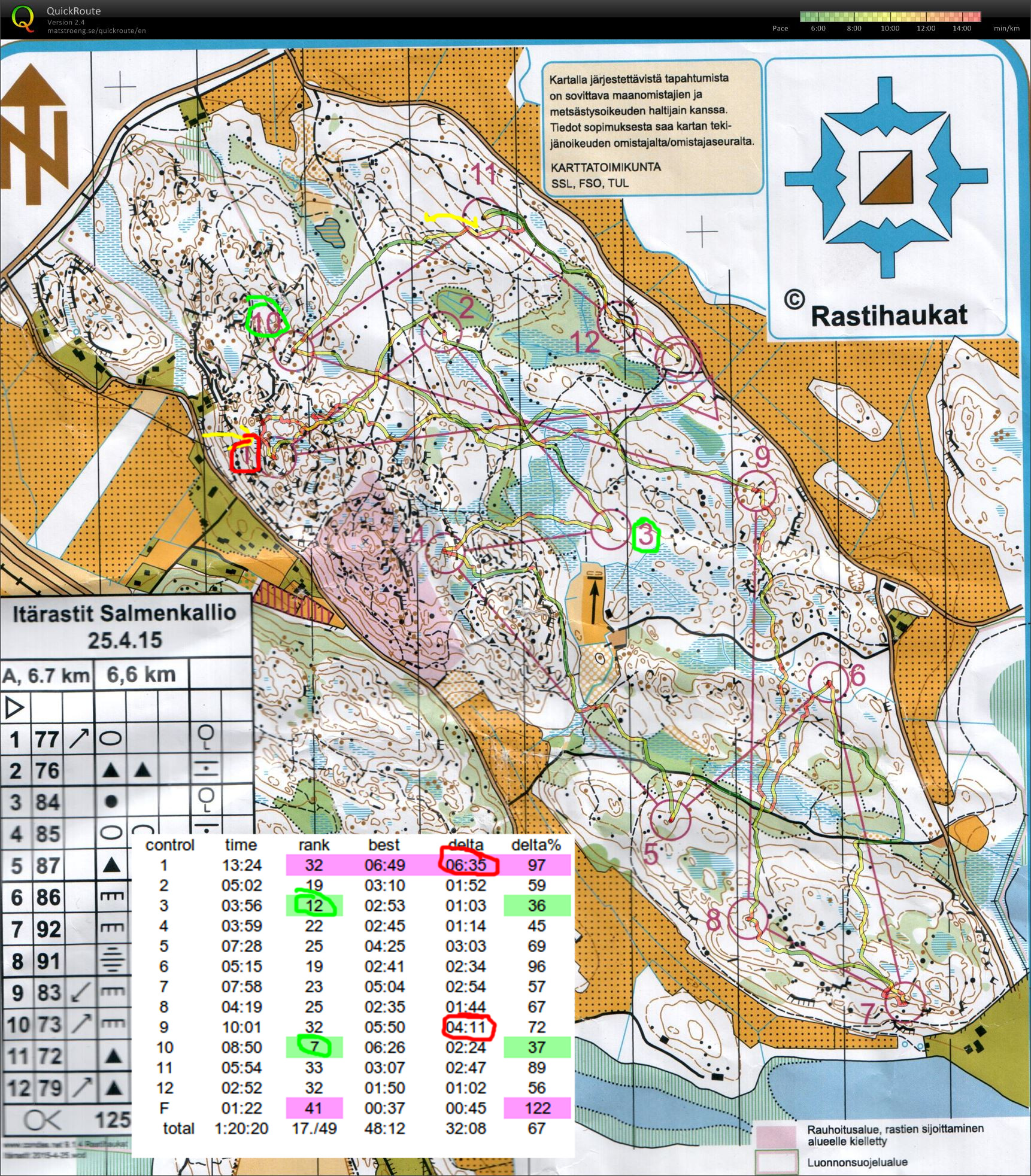
Worst split (45th) and at least +1min of error right at the start on #1. The first control always deserves a bit of respect - steady and safe is better on #1 than too much speed&risk and a mistake.
#2 OK. Some kind of U-bend on #3 but not too much time lost. Towards #4 I slow down midway for some reason, maybe a bit north and around the blue swamp would have been better.
I almost run past #5 but stop and look around for the flag at the last possible moment.
#6 is the best split (5th) although it did not feel that special. Safely along the path first and then via the bigger cliff that indicates a direction into the control circle. #7 again OK.
#8 and #9 were clearly in the toughest part of the map and I had decided to take them extra carefully.
#8 went well first on the bigger path, then up towards the control on a smaller path, and the last bit through the blue swamp.
#9 did not go well. I take a straight and direct route but that means climbing and descending a lot of cliffs and hills. Over 3 minutes lost to the best runner. It would probably have been much better to go directly northeast out of #8 to the path (yellow arrows), follow the path as far as possible, and then find the control from above (yellow arrow).
#10-#11-F are all along the big path running parallel to the road. When I arrive at the path before #10 I'm unsure if I am left or right of the control? Probably +1min lost reading the map and looking around.
#11 and F require no orienteering, just trail-running.