Here's an example of using PPP-tools to compare PPP solutions from NRCan gpsppp, ESA gLAB, and RTKLIB.

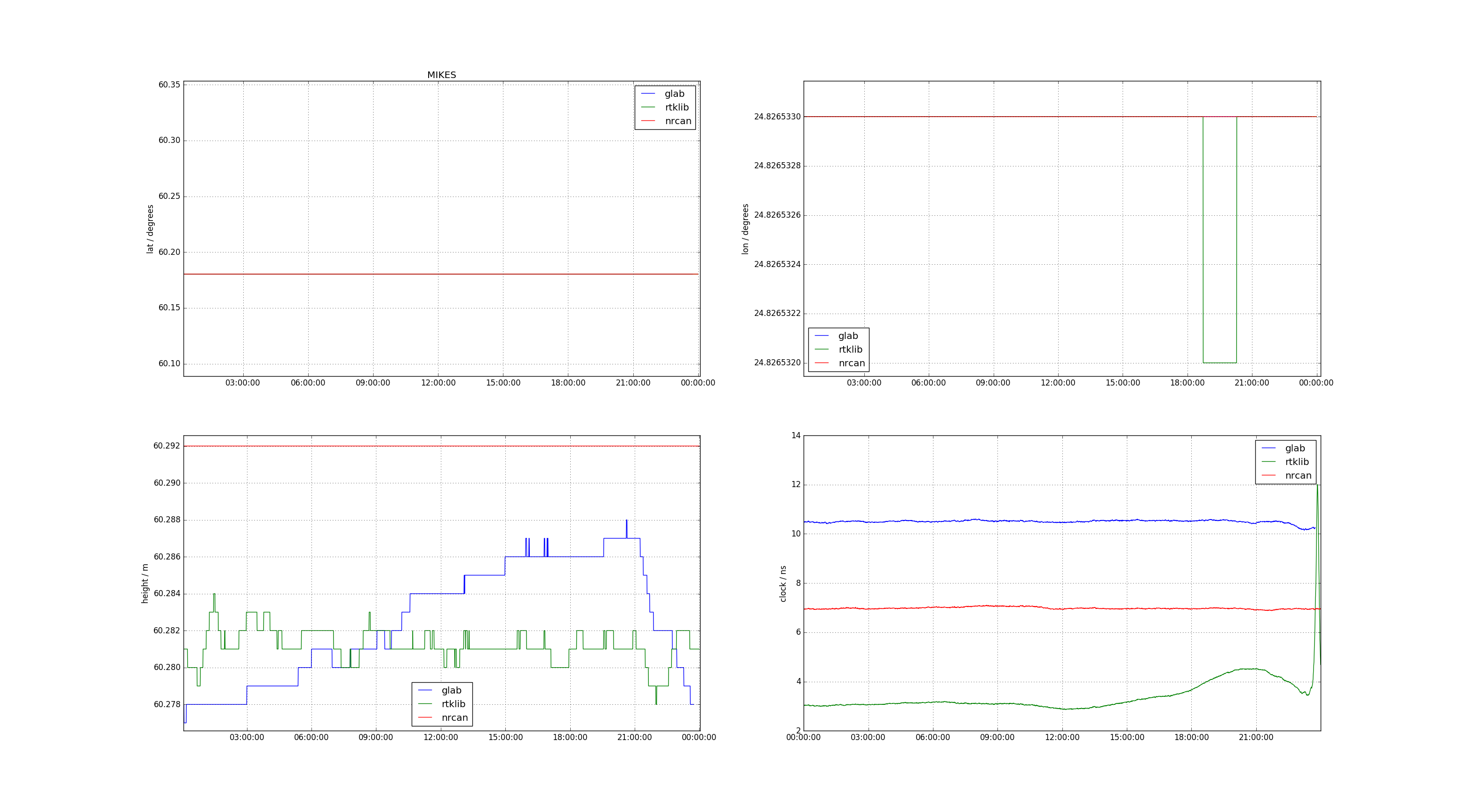
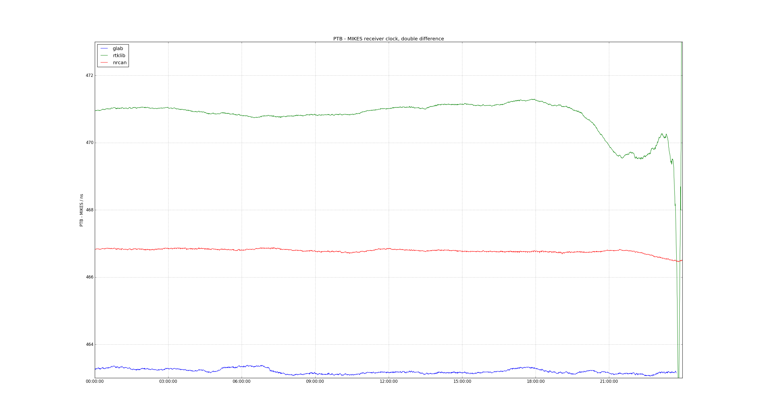
It seems that all programs fix the lat/lon output. However both gLAB and RTKLIB leave the height as a variable parameter. Interestingly it seems there is some peak at the end of the PTBG data and gLAB compensates by raising the height while RTKLIB compensates by raising the clock value.