Nokia N900 vs Garmin Edge800 GPS comparison

On Wednesday I had a Garmin Edge 800 (red line in the pics) on my bike while Risto was using a Nokia N900 (blue line). Here are a few comparisons of the GPS-traces. Our bikes were obviously not exactly following the same route, so that accounts for some of the differences. The Edge800 seems to take GPS-samples a more often than the N900.

See also N95 vs 405cx testing here and here.

Sunday bike ride

First longer ride with the new road bike.

Ride details: 110km, 6h 29min (includes ca 52 min of breaks), avg speed 16.9 km/h, avg HR 123, 2124 kcal.

Bike details: Sabbath September frame with SRAM Rival groupset, 25mm wide 700c Continental tyres. I changed the saddle to a Brooks B17 and fitted a shorter 90mm Easton stem. The saddlebag is a Carradice SQR slim and the bar bag is an Ortlieb classic. Garmin Edge 800 GPS/computer. Shimano A-530 pedals.

Saturday 20k bike ride

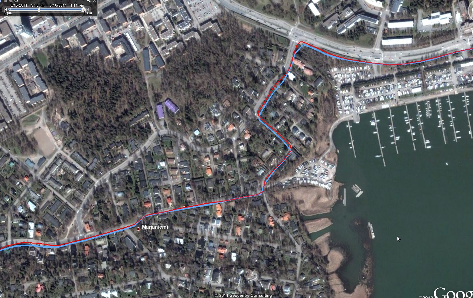
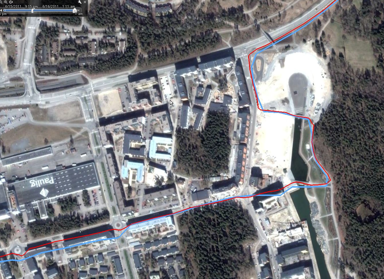
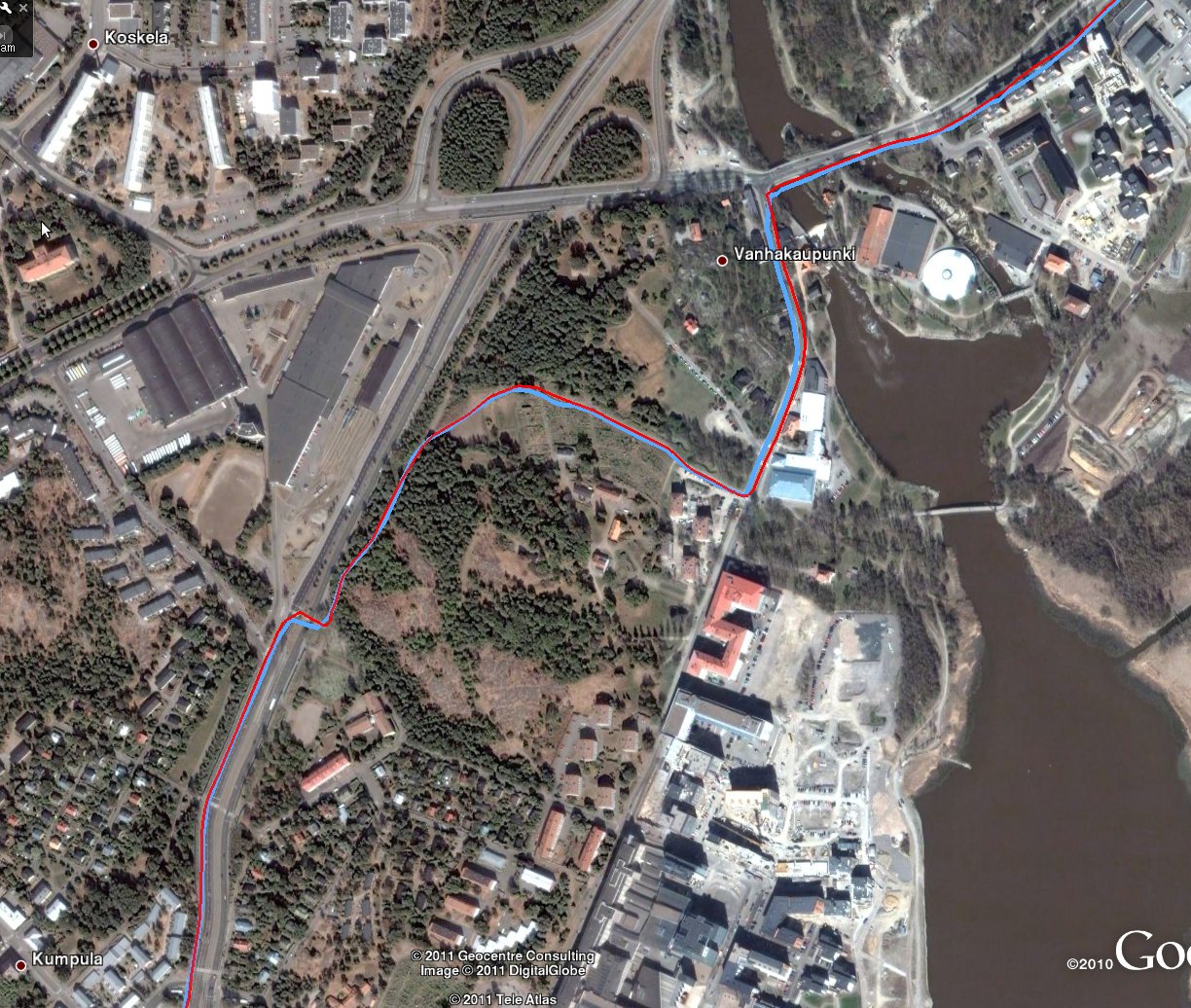
Biking in the early spring is a messy business. Most of the roads are now free from ice and snow, but the bike-paths are all covered in remains of sand and gravel from the winter with the occasional patch of ice, snow, or a wet slurry. Even with reasonable fenders on the bike your back and legs are pretty much covered in mud after an hour.

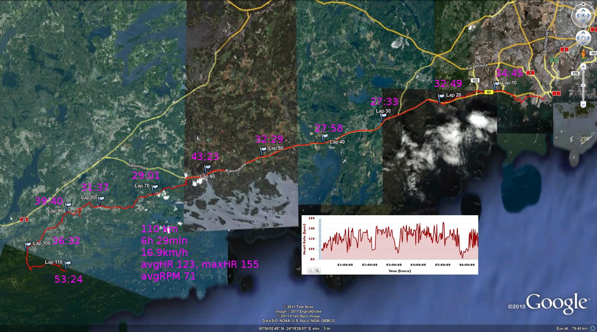
Data is from my latest gps-toy, which supports openstreetmap! (20.1k in 58mins, avg-speed 20.8km/h, avg-HR 148, temp +0 C)

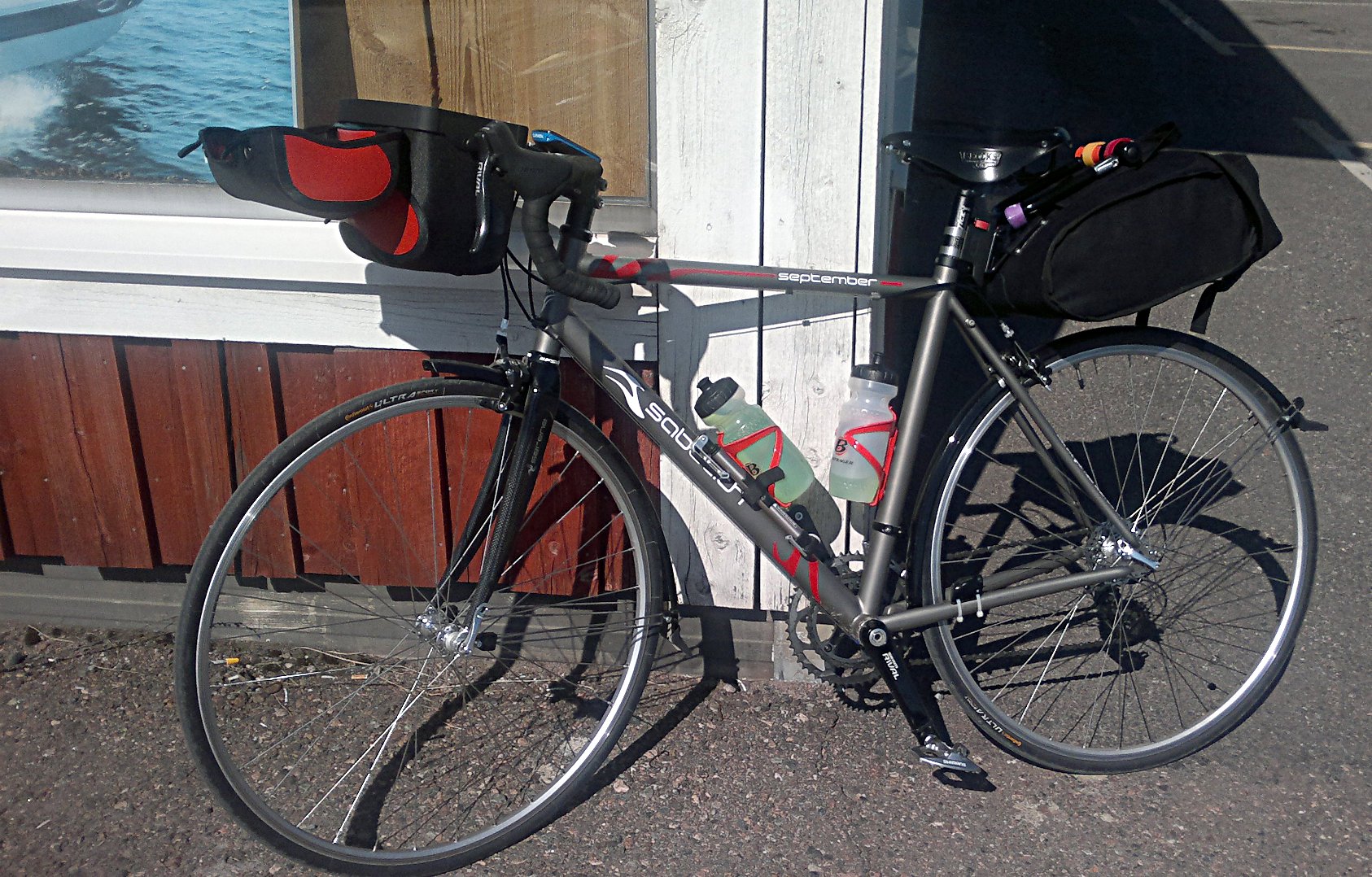
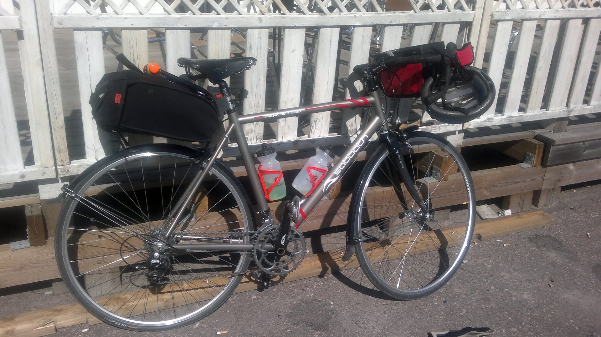
Come spring/summer the plan is to put in some longer training rides to complement the running training. Maybe even some brevets on the new road-bike.

The temperature measurement circuit or transducer on the edge 800 seems to have a long-ish time-constant of about 15 minutes:


Tuesday 50km bike ride

Despite aviation strikes both in Finland and in Spain I am back home and can move all the GPS-data onto the laptop (remember to pack the ANT usb-stick next time!). I've added pictures of the GPS traces for the Sunday (half)marathon, Wednesday sailing trip, and Thursday bike ride to posts below. Here's some biking from Tuesday:

2010nov30_tisdag_cykling_50km

Starting from Puerto del Carmen it is a flat ride along the coast past the airport to Arrecife. From Arrecife to Costa Teguise we couldn't find a nice bike path but were forced out onto busy roads with cars. Through an industrial area with the harbor and a ghost-ship. Some light lunch in Costa Teguise before heading uphill. There's a really steep climb at 25km on the elevation curve which is just after the golf-course in the upper right corner of the picture, heading up towards Tahiche. From there we took an unpaved road towards San Bartolome and another quick stop before rolling downhill to the coast again.