Itärastit, Ämmässuo

2014-08-30_ITR_ammassuo_qrSlow and safe without major mistakes.

Unnecessary bends/loops a bit before #2 and just before #4. Clearly the wrong direction out of #5, and then quite confusing out of #6 where the yellow area on the map was actually thick forest!? Up the hill to #7 a little too early and some searching for the control on top of the hill. A very slow route to #9 with almost 9 min lost 🙁

Faster allantools with numpy

Update: these slopes are both linear, or O(n), where n is the input data size.

allantools_adev_bench_linear

However for the worst performing algorithm, MTIE, an O(n*log(n)) algorithm that uses a binary tree to store intermediate results is possible. This algorithm restricts the tau-values to 2**k (with k integer) times the data interval.

allantools_numpy_bench_2014-08-31

Danny Price has made a fantastic contribution to allantools  by taking my previous pure python code (hacked together in January 2014, shown in red) and numpyifying it all (shown in blue)!

For large datasets the speedups are 100-fold or more in most cases!
The speedups are calculated only for datasets larger than 1e5, since python's time.time() doesn't seem suitable for measuring 1 ms or shorter running times.

Firmaliiga 6/2014, Luukki

2014-08-26_FL_luukki_qr_splits

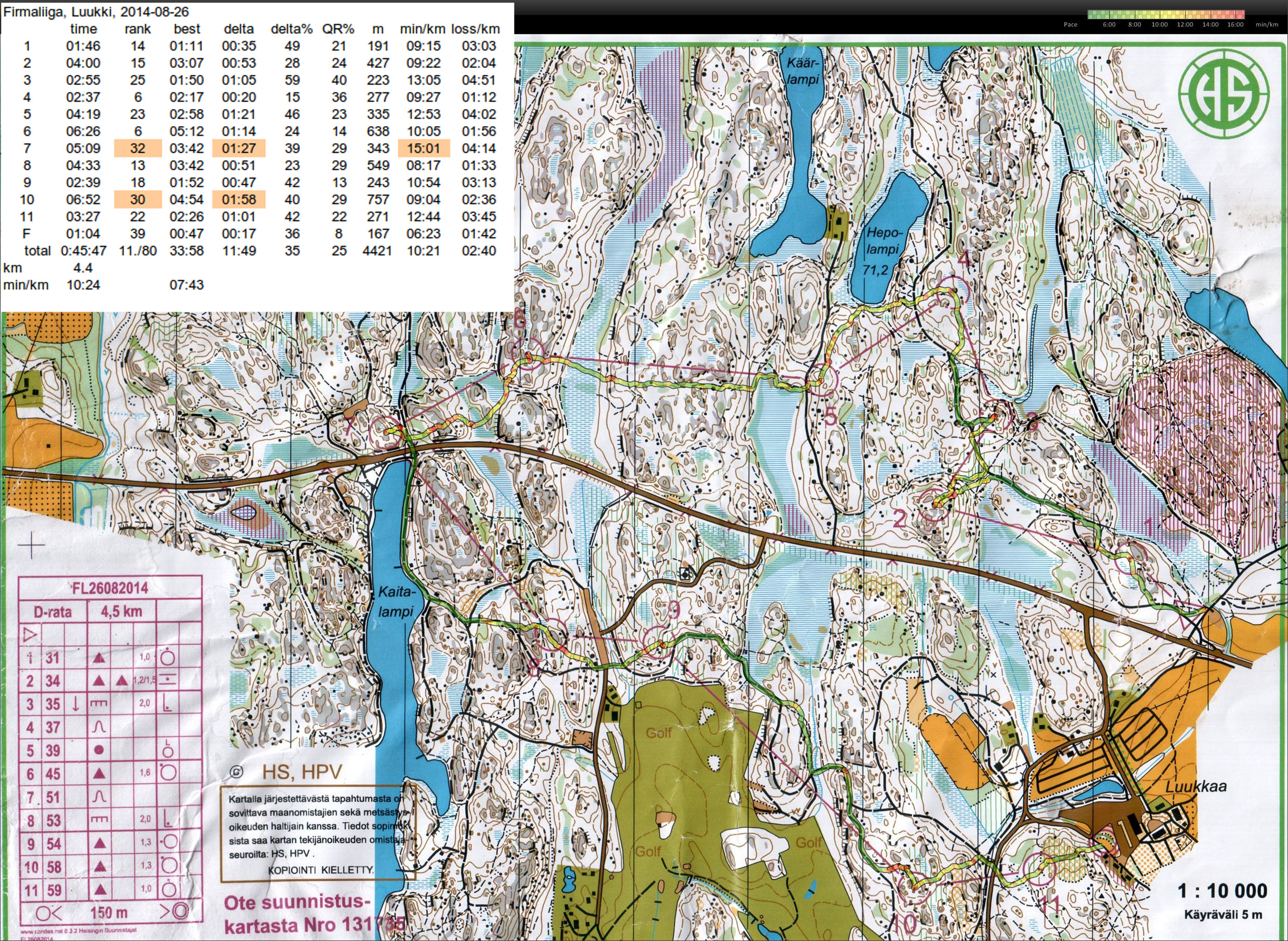
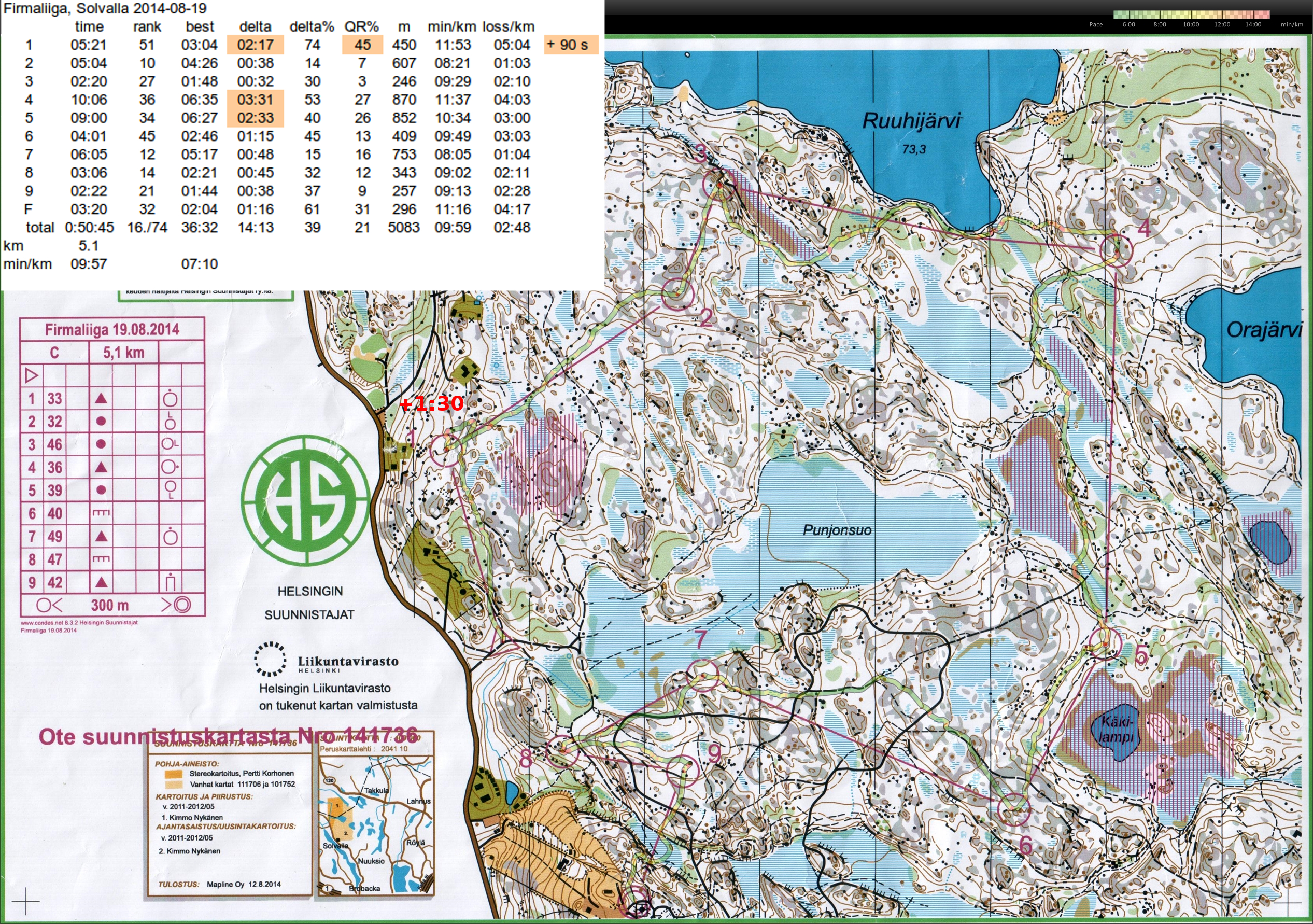
Last firmaliiga event this year.

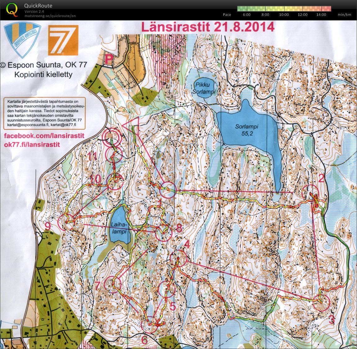
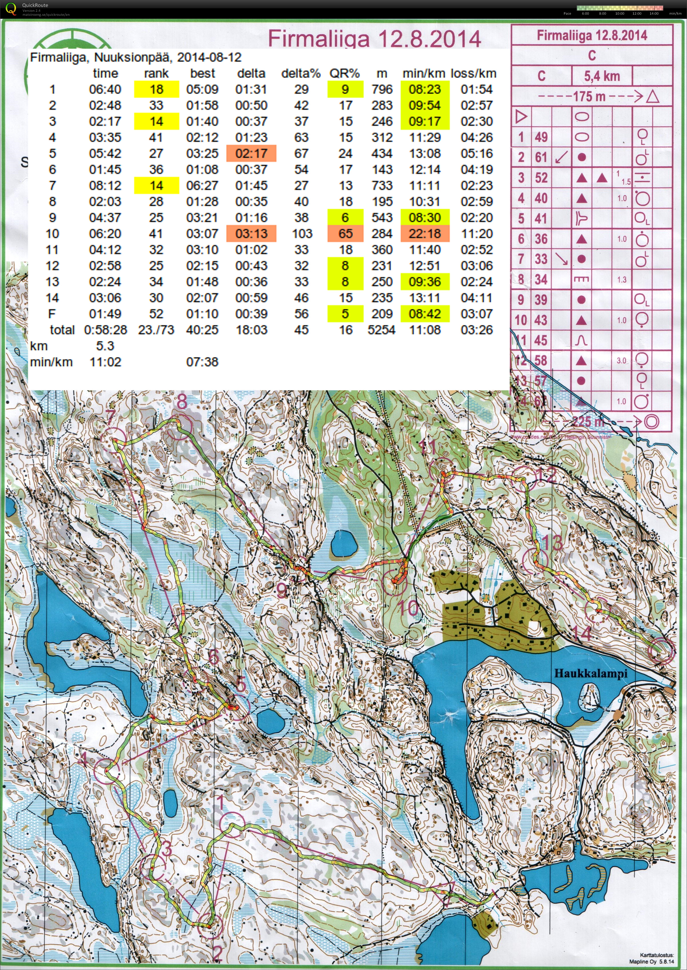
This course often had a clear path/road as one route choice. Decent running with an overall 11./80 placing.


Best splits are #4 and #6 where I was 6./80 - not bad!

From #3 I didn't even consider a direct route, just quickly back to the big path. Then up onto the slope, with a small cliff and stone providing verification of my exact location. Over the grey open cliff and a bit further I see the flag. Not much thinking, stopping, or walking - just execution.

#5-#6 was the second longest leg and possibly the most challenging? Out of #5 just after the first blue swamp I made a conscious decision to go south - not directly over the hill along the control-line, and instead ran along a path with the big stone and cliffs as mid-way checkpoints. Then down onto the second blue swamp, and following other runners up onto the stony slope towards #6 - enough other people there so no searching for the flag required. Again mostly just executing a good plan with very little standing around or slow map reading. Good.

The worst splits are #7  and #10. Out of #6 I had a clear plan to go a bit north, down the hill north of the steep cliff, find the smaller path and use that to get to the bigger path. Execution of this plan however was poor and instead I drifted towards the road and climbed two hills for no use. Close to #10 I stepped off the path too soon, stood around wondering for a while, and then followed others to the control - it didn't feel that bad but  1:58 lost to the best runner is a lot and only 30th in the splits...
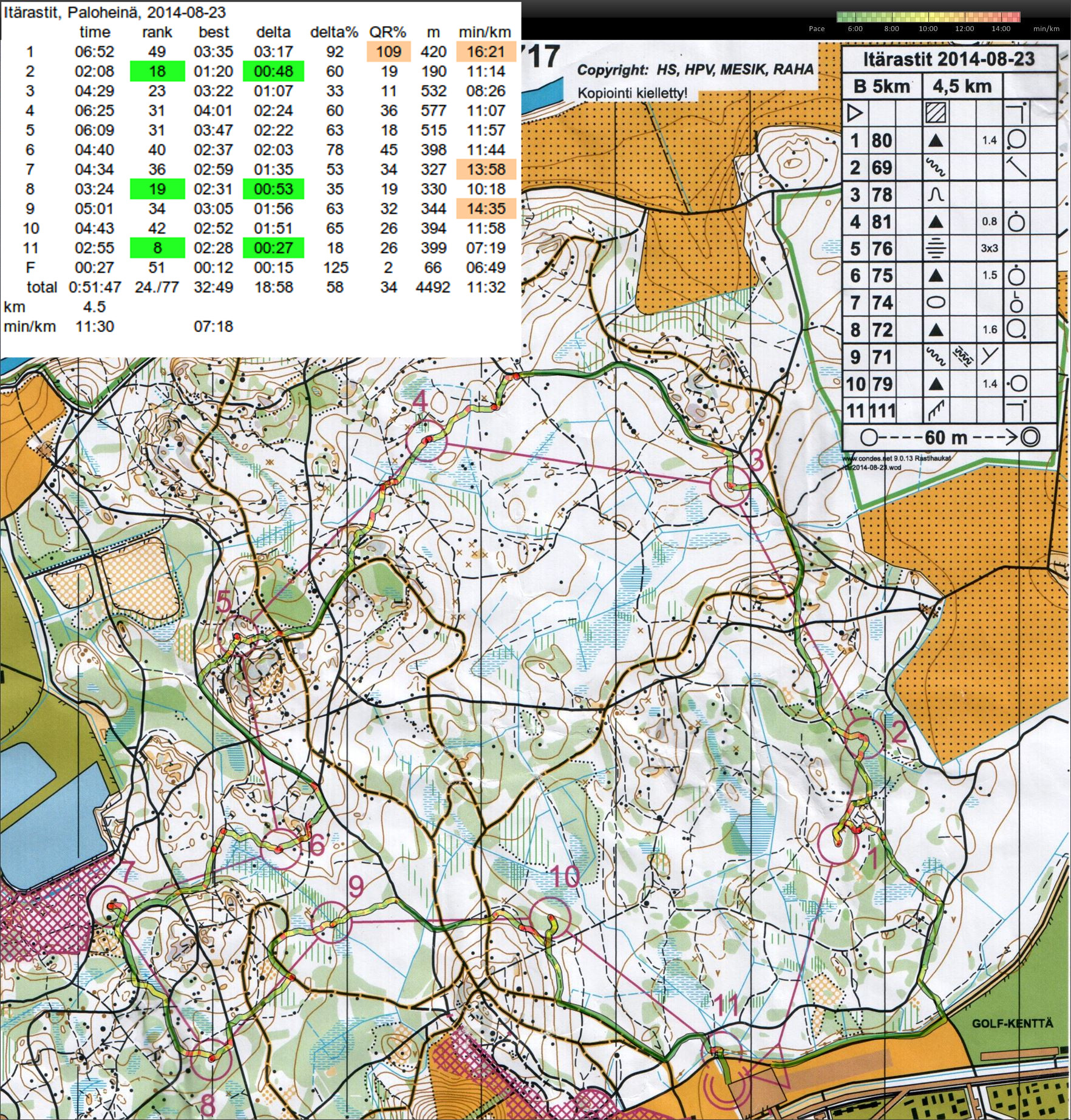
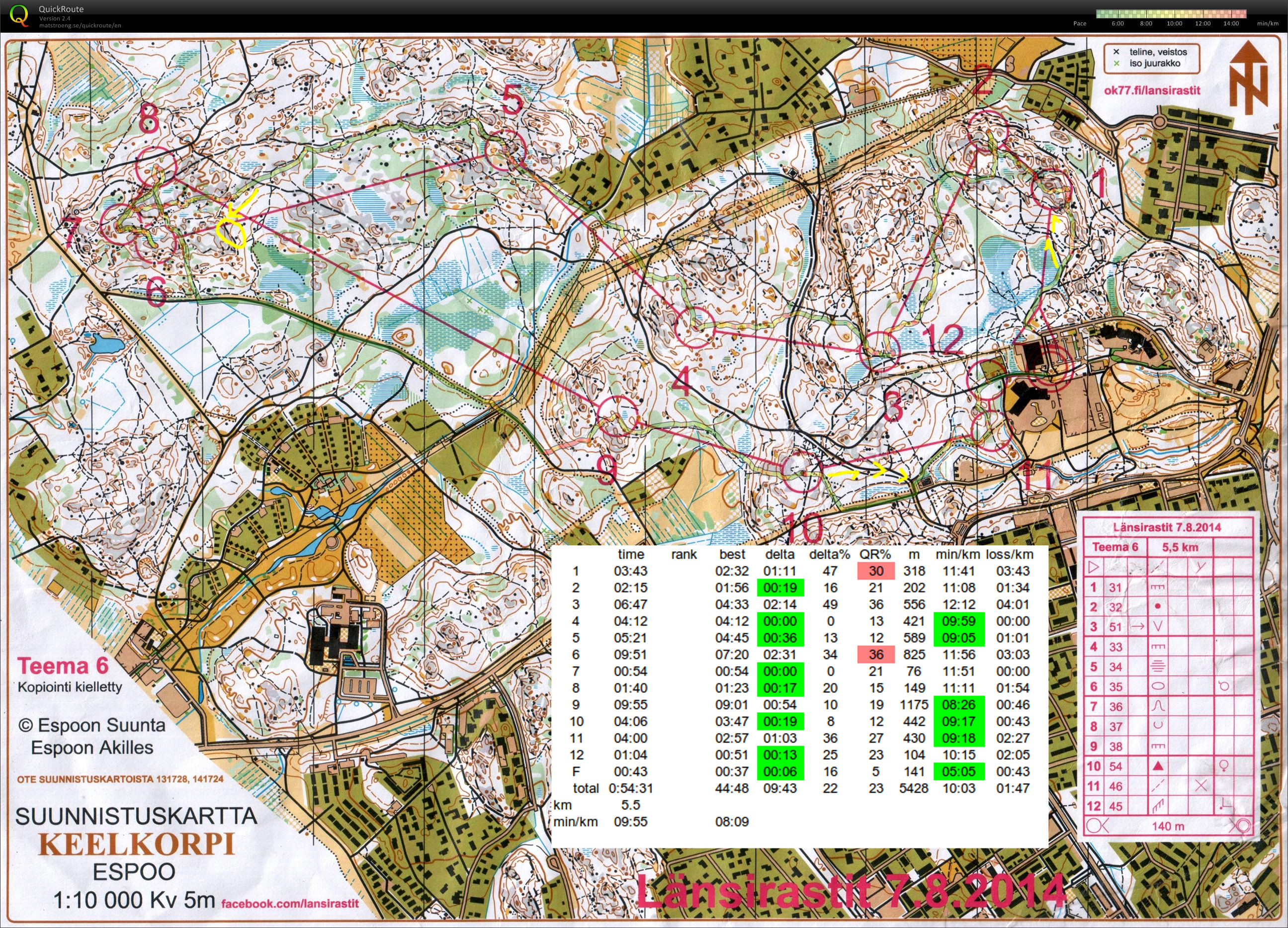
Länsirastit, Kaitakorpi

2014-08-21_kaitakorpi_qr

A good run on Tuesday at Firmaliiga resulted in much tiredness both in the legs and in the mind on Thursday. I search for #1 too soon and to the right, try to find #2 too late and on the wrong hill, make a mess out of what looks like an easy #5-#6 leg, take a bad direction out of #8 to round the lake to the north, and finish off on #10 by running just past the control inside the circle.

Anyway they all count as experience I guess... 🙂

Firmaliiga 5/2014, Solvalla

2014-08-19_FL_solvalla_qr_splits

The second firmaliiga event this fall, at Solvalla quite close to the first one.

Close to #1 I should have had a better plan - I've just graced the control-circle and then looked in the wrong direction for some random big stone. Around 90 s lost.

#2-#3 quite OK. To #4 my route is probably too zigzaggy - less turns and leaving all the green areas to the left(north) is probably better.  To #5 the paths on the left were apparently a bit clearer and faster? To #6 I was too high up the hill and didn't find the path.

#7-F is quite OK again.

Länsirastit, Lahnus

2014-08-14-kalajarvi-qr-splits

S-#1-#2 OK, then towards #3 should have rounded the steep cliff altogether and avoided the ascent/descent after #2 - still #3 and #4 are among the best splits.

A complete blackout after #4 when I ran 180-degrees in the wrong direction for a while 🙁

#6 OK but then very close to the correct stone at #7 a loop to the right instead. #8 is again a good split - mostly running along paths and roads.

Then again completely the wrong direction out of #8 🙁 #10 and #11 look like good splits but didn't feel that great as the vegetation was thick and thorny.

Itärastit, Latokartano

2014-08-09_latokartano-qr-splits

An easy course where the challenge was keeping up speed and planning well ahead so that there were no walking breaks or stops. 4th out of 40 runners is pretty good although the level isn't that high on these Saturday events 🙂

  • #3 somehow ran past the control and up the wrong hill. over 2 minutes lost 🙁
  • My zigzag route to #5 isn't good. Straighter or staying on one side of the control-line would be better.
  • To #7 along paths - safe but maybe too slow. Perhaps straighter down the hill out of #6 would have been faster.

Firmaliiga 4/2014, Nuuksionpää

Fourth firmaliiga event of the year yesterday at nuuksionpää in the Noux national park.

2014-08-12-nuuksionpaa-qr-splits

  • #1-#4 mostly OK, perhaps a bit slow/unsure running to #1.
  • #5 a lot of time lost here for some reason - maybe straighter along the #4-#5 line has less ascent/descent?
  • #6-#9 again mostly OK
  • #10 only major mistake - quite thick forest with low visibility, I wasn't high enough up on the hill, and ran through to the road behind the control before turning back and finding it.
  • #11-F OK.


Länsirastit, Olari

2014-08-07-olars-qr-splits

After a summer break it's time to start orienteering again.

Stable, controlled, and positive run today! Perhaps because rain and thunder had lowered the temperature by five degrees to around +22C so it wasn't as hot as otherwise lately.

  • at #1 should have followed the path for a bit longer, and read the map more carefully to check that the control is actually quite high up on the hill.
  • #3 perhaps a straighter route in the beginning - and then "punching through" to the big path with speed instead of a tentative J-bend close to the control circle.
  • Found #7 before #6 - should have used better intermediate checkpoints when stepping off the path close to #6
  • To #11 I actually planned to take the norther road but then aimlessly ran down the hill out of #10 and found myself on the straight road south of #10.